Km 0
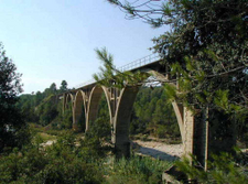 The
Greenway begins at the Arnes-Lledó station
alongside the river Algars which at this
point forms the border between the
autonomous communities of Aragon and
Cataluña. The buildings of what used to be
the station are on the Catalan side of the
river. The abandoned station is barely one
kilometre from the village of Lledó while
Arnes is some 8 km away. From here we take a
track running parallel to the railway line
which leads to a recreational area where you
can go for a swim if the weather is right.
Five kilometres and one tunnel after leaving
the station, a broad bend signals our
arrival at the former Horta de Sant Joan
railway station (Km 5). If we look in the
direction of the railway line, straight
ahead of us is the Cerro de la Ermita (or
Cerro de Santa Bárbara), a hill topped by a
hermitage.
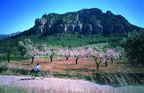 A
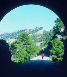
little later we pass through the second
tunnel on our route. On leaving the tunnel
we come face to face with an imposing
landscape characterized by huge mountains
covered with almond and pine groves.
Straight ahead a spectacular craggy rock
called the Muela den Canar rears up before
us.
From here the Greenway runs alongside the
river Canaletes until the end of the route.
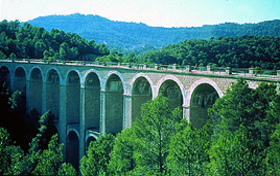
A succession of tunnels and viaducts
punctuate the remaining kilometres. Among
the most picturesque viaducts is the one at
Km 8.5 which spans the Barranc del Molí del
Cap ravine, and another at Km 10 which
crosses high over the pine trees concealing
the water course at the bottom of the
Barranc de la Balloca ravine. Their elegant
arches put us in mind of Roman aqueducts and
the ancient Roman capital of the province,
Tarraco, which is not so far away.
Km 13
 When
the hermitage of Sant Josep comes into view,
we know we have arrived at Bot. The village,
which is close by the station, is a good
place to stock up on provisions, especially
water, as until we get to La Fontcalda (Km
19) there is no other source of drinking
water.
The Greenway continues through cuttings,
viaducts, and tunnels before passing under
the Muela den Canar crag. The last tunnel
in this section, which is 739m long and
curved, is the longest one on the entire
route.
Km 17,5
At the far end of this long tunnel are what
remains of Prat de Comte station, which is
about 4 km away from the village from which
it takes its name, along a steep but quiet
road. At Km 18.5 our Greenway crosses the
track leading to the Santuario de La
Fontcalda. It should be noted that
physically impaired people may find the
steep slopes leading up to the sanctuary
difficult to cope with.
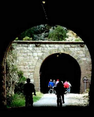 Apart
from being a charming spot and a place of
rest and repose, in summer and on some
weekends La Fontcalda is also a place where
Greenway users can stock up with water and
provisions. One of the most spectacular
spots in this area is Els Estrets de Dalts,
where the river Canaletes squeezes between
high crags. A path hewn into the rock
enables visitors to reach the bottom of the
gorge and swim in the river. This area also
boasts a magnificent railway viaduct across
the Arroyo de Fontcalda stream.
This stretch of Greenway to El Pinell de
Brai station doubles up as the PR-C-98 Terra
Alta hiking route. We pass over more
viaducts and through more tunnels until we
reach Km 20 and the tunnel which caused the
railway to be closed when there was a major
cave-in, right in the middle of the tunnel.
Here we make a detour using a not too hilly
path that goes around the tunnel.
Km 23,7
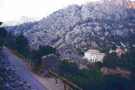 Finally
we reach the platforms of Pinell de Brai
station. As in the case of Prat station
before, the town of Pinell is some 6 kms
away over mountain roads.
Here is where the Terra Alta Greenway ends,
but it need not be the end of our journey
since it is possible to continue along the
Baix Ebre Greenway for a further 26 km
towards the Ebro and Tortosa, emulating the
journey of the “Sarmentero” (The Vine Cutter)
train.
