|
Pending its future prolongation to Elizondo, the Bidasoa Greenway described here starts at Legasa, taking advantage of the gentle downward slope alongside the river Bidasoa.
However, another very commonly used starting point is the Pausu bridge in Behobia, the border crossing point to France located at the northernmost point of our Greenway. Not for nothing is Behobia, a district of Irun, the gateway to the city of Irun proper leading us to the city of Donostia/San Sebastián and the westernmost valleys of the Navarre Pyrenees.
Km 0
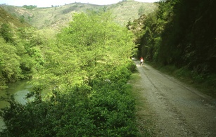
It is easy to find the start of the route in the pretty main square of the small village of Legasa, part of the municipality of Bertizarana. After skirting around a complex of large industrial buildings, the old railway line reaches the River Bidasoa. Sheltered by leafy trees, the route runs alongside the river and its riparian woodland for a short while before arriving at the town of Doneztebe/Santesteban. We rejoin the greenway at the Intzakardi Parkon the way out of the town to the south, on the left bank of the Bidasoa, just where it is joined by its tributary, the River Ezkurra. On the far side of the bridge over the River Ezkurra the route continues along a wide, concrete surfaced rail bed.
Care needs to be taken in this section since it is not only used by walkers and cyclists; livestock and vehicles also use the same disused railway to access neighbouring properties. We need to respect the passage of livestock and be wary of the small amount of motor traffic there is, even though it is subject to a low speed limit.
Km 9,3
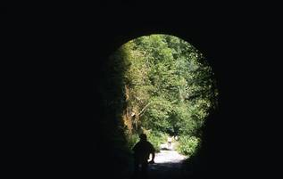 The route passes through dense overhanging woodland and three tunnels, 15 and 70 m and 90m in length respectively, before arriving at Sunbilla, 9,3 Km from our starting point. The Bidasoa runs through the middle of the town and a magnificent medieval bridge links the two sides. We recommend that you visit this town, as well as the towns of Baztán, Bertizarana, Malerreka, and the Bortziriak-Cinco Villas (the Five Towns, comprising the small towns of Arantza, Igantzi, Lesaka, Etxalar and Bera), with their typical stone houses and windows adorned with flowers. The route passes through dense overhanging woodland and three tunnels, 15 and 70 m and 90m in length respectively, before arriving at Sunbilla, 9,3 Km from our starting point. The Bidasoa runs through the middle of the town and a magnificent medieval bridge links the two sides. We recommend that you visit this town, as well as the towns of Baztán, Bertizarana, Malerreka, and the Bortziriak-Cinco Villas (the Five Towns, comprising the small towns of Arantza, Igantzi, Lesaka, Etxalar and Bera), with their typical stone houses and windows adorned with flowers.
After Sunbilla, the Greenway enters a section in which the mountains begin to press in on the river. The concrete pavement ends 2 Km from the town and gives way to a dirt track, although the surface is still of a good quality. Care needs to be taken in this section since it is not only used by walkers and cyclists; livestock and vehicles also use the same disused railway to access neighbouring properties. We need to respect the passage of livestock and be wary of the small amount of motor traffic there is, even though it is subject to a low speed limit. Moving on towards Igantzi we pass through a 208 m curved tunnel. Although it is fitted with lighting we advise users to carry flashlights or cycle lamps. The Bidasoa is never more than a few metres from our route. Every so often there are small dams feeding hydroelectric power plants. “Fish ladders” have been built so that these dams do not prevent fish from swimming upstream.
Km 17,3
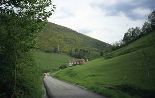 On the opposite bank to the busy main road, the Greenway makes its peaceful way through meadows and woods to Bera (Vera de Bidasoa), without passing through any intervening towns or villages. At Km 15 some isolated ruins mark the site of the former Igantzi (Yanci) railway station, now home to tons of wood chips from a nearby sawmill. On the opposite bank to the busy main road, the Greenway makes its peaceful way through meadows and woods to Bera (Vera de Bidasoa), without passing through any intervening towns or villages. At Km 15 some isolated ruins mark the site of the former Igantzi (Yanci) railway station, now home to tons of wood chips from a nearby sawmill.
The trail now heads towards the Cruce de Lesaka (Lesaka Crossroads, Km 21) passing through another tunnel (the Onbordi tunnel) which is 160m long and is equipped with lighting. The Cruce de Lesaka area, previously home to Lesaka’s railway station, has been affected by the arrival of a service station and a truck park.
Continuing along the old railway line we skirt around the Tellería tunnel, now taken over by the new road. Soon we reach an old Spanish Civil War bunker which was built to watch over the banks of the Bidasoa (entrance to the bunker is via a small tunnel on a line branching off the old railway itself), and an old water fountain. These two features lend a certain local colour to the route.
Km 24,3
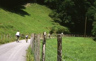
After passing through areas of great natural beauty we arrive at the pedestrian bridge built over the Irun-Pamplona road in 2012. Further along the trail we reach a bridge over the River Bidasoa which provides vehicle access to the old town centre of Bera. However our railway line does not cross the river by this bridge; instead it reappears as a small asphalted track running along the left bank of the Bidasoa.
The town of Bera is opposite Km 24.3. It has an incredibly beautiful town centre, featuring typical old houses whose balconies and windows are adorned with colourful pots of vibrant flowers. The town, home of the Baroja family, lies on the opposite bank, over the pretty mediaeval San Miguel bridge. We can reach this bridge by taking the first turn-off on the right after leaving the road and regaining the greenway proper. In the middle of the bridge there is a plaque commemorating the company of British riflemen who heroically defended the bridge against thousands of French troops during the Peninsular War.
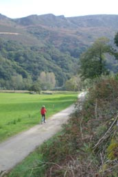
After Km 27.3, the greenway surface is once again compacted earth and enters another spectacular section. The Bidasoa is hemmed in by the high hills of the Pyrenees. The scenery we can enjoy today has remained unchanged from that which the railway passengers of yesteryear enjoyed in the past. A forest that does not seem to have changed in centuries covers the steep slopes with oak, pine and hazel. Depending on the time of the year, travellers will be bathed in autumnal ochres, spring greenery, or summer bareness. With the river running through a narrow defile and the usable width reduced to the bare minimum, the railway is forced into a number of tunnels in order to negotiate the steep terrain, which undoubtedly adds to the enjoyment of this section. A total of five tunnels were bored, one of them 195 m long and curved. Another has a strange opening on the side giving on to the river, forming a peculiar, albeit somewhat dangerous, viewpoint over the river Bidasoa.
Km 31,3
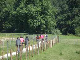 The Greenway enters the province of Gipuzkoa in Endarlatsa (Km 31.3), a hamlet comprising a couple of old country houses marking the border or frontier between Navarre, the Basque Country and France. Endarlatsa was a milestone of the former railway. The original “Txikito” train, the forerunner of the Bidasoa railway, originated here. The English mining companies operating in the area set up their centre of operations at Endarlatsa, where they had facilities for handling, loading and unloading ore. Such was the importance of this place that there was even a train stop at Endarlatsa, which strangely enough was built on Navarra soil. The station building, still in a good condition today, is on our left before we pass under the bridge arch under the old road. The Greenway enters the province of Gipuzkoa in Endarlatsa (Km 31.3), a hamlet comprising a couple of old country houses marking the border or frontier between Navarre, the Basque Country and France. Endarlatsa was a milestone of the former railway. The original “Txikito” train, the forerunner of the Bidasoa railway, originated here. The English mining companies operating in the area set up their centre of operations at Endarlatsa, where they had facilities for handling, loading and unloading ore. Such was the importance of this place that there was even a train stop at Endarlatsa, which strangely enough was built on Navarra soil. The station building, still in a good condition today, is on our left before we pass under the bridge arch under the old road.
Endarlatsais also a strategic site. Its name is closely linked to a still standing defensive tower and a bridge crossing the Bidasoa, because from there until its estuary the river serves as the natural frontier with France. For this reason the new and old N-121-A roads and the old road that preceded them switched river banks over their respective bridges to join the railway on the Spanish side of the river.
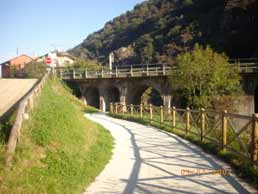
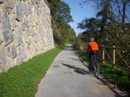
Once over the provincial border we plunge into the Aiako Harria (Peñas de Aya) Natural Park. The singular beauty of its rocky peaks combines with the geological interest of the area; it is the only granite massif to be found in the Basque Country, formed by the oldest rocks in the region. In this section of the greenway, developed by the Provincial Government of Gipuzkoa, the mountains are wider apart and in the valley bottom they allow for a broader floodplain. But with only one hillside on which to run, the road has occupied the former rail bed. However, the new road has moved up the hillside, leaving our greenway to occupy a level closer to the lively river. A short, steep slope leads us down to an asphalted track which then gently drops down parallel to the rock wall supporting the old road.
Just after the easy-going tarmac surface runs out, our trail leaves the river for a short distance and strikes out across a flat open meadow, providing us with a good view of the mountains around us. Previously, our view had been curtailed by the slopes on the left bank and had allowed us to see only the French side. It was over this border that many Spanish fled from hunger and oppression, although the River Bidasoa was crossed many times secretly in both directions in days gone by.
 Rounded rock formations crowd the Bidasoa from the French Osinkocelaia and the Spanish Pagogaña mountains, causing the river course to become narrow and sinuous. The previous water meadow disappears and at a sharp bend in the river we come across the San Miguel Apeadero (33.3 km), clearly identified by two large signs. It is a tall, now abandoned building fronted by a large forecourt lined with majestic plane trees providing ample shade. The new route gives us a good view of how the river begins to flow more rapidly. Small rapids and a river bed of large pebbles make up a circuit in which hanging bars provided a fun slalom course for canoeists. Rounded rock formations crowd the Bidasoa from the French Osinkocelaia and the Spanish Pagogaña mountains, causing the river course to become narrow and sinuous. The previous water meadow disappears and at a sharp bend in the river we come across the San Miguel Apeadero (33.3 km), clearly identified by two large signs. It is a tall, now abandoned building fronted by a large forecourt lined with majestic plane trees providing ample shade. The new route gives us a good view of how the river begins to flow more rapidly. Small rapids and a river bed of large pebbles make up a circuit in which hanging bars provided a fun slalom course for canoeists.
The San Miguel station building today turns its back on the traveller since the train used to pass on the side we cannot see. The main facade and the loading facility which used to fill trains with mineral ore extracted further up the hillside are not visible to Greenway users. In order to exploit the important mining district of San Fernando, the Ferrocarril de las Tres Coronas railway was built, which is the name given to the Peñas de Aya (Aiako Harria) crags on the French side. The train started out from Aireko Palazioa, a spectacular railway house with a canteen and accommodation for railway workers which would later come to be known as the Palace of the Englishmen. At a height of about 500 m, it ran for a 5 km long flat section to Mount Pagogaña, where the two large inclined planes of San Miguel and Txaradi were sited, and onwards to the San Miguel Apeadero. The wagons used to be lowered down the inclined plane before being unloaded onto a plate supported by four iron pillars and fitted with screens (sieves) through which the ore pass before being loaded onto the Bidasoa railway wagons.
 100 metres further on, at the foot of the Laminarri viaduct, two barriers bar the way to motor vehicles and force cyclists to slow down. A spectacular gorge rises above the viaduct carrying the new road, reaching the top of Mount Pagogaña where we can see the remains of a fort severely damaged by the bloody fighting of the Civil War. Pagogaña Fort used to form part of a modest defensive line, without artillery, built after the last Carlist War (1872-1876), which included the Endarlatsa and Pika towers. 100 metres further on, at the foot of the Laminarri viaduct, two barriers bar the way to motor vehicles and force cyclists to slow down. A spectacular gorge rises above the viaduct carrying the new road, reaching the top of Mount Pagogaña where we can see the remains of a fort severely damaged by the bloody fighting of the Civil War. Pagogaña Fort used to form part of a modest defensive line, without artillery, built after the last Carlist War (1872-1876), which included the Endarlatsa and Pika towers.
After the barriers the Greenway once again runs parallel to the old road, now quiet, empty, and resting after the hustle and bustle of bygone days. The Greenway then dips and rises in order to regain the level of the road, where a rest area with several picnic tables occupies an elongated stretch of ground nearby (km 33.9).
Km 34,3
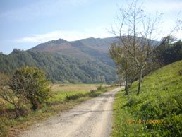 The mountainous valley sides once again give us more room and the water meadow broadens to form a broad area of grassland, dominated by the sheds and barns of the Lastaola farm. The Greenway and the river now separate, leaving a grassy margin between them. This strip of grassland is bordered by the river on its right and the Greenway and road on its left. The mountainous valley sides once again give us more room and the water meadow broadens to form a broad area of grassland, dominated by the sheds and barns of the Lastaola farm. The Greenway and the river now separate, leaving a grassy margin between them. This strip of grassland is bordered by the river on its right and the Greenway and road on its left.
On the Guipúzcoa side the mountains are increasingly more distant. However, on the French side they can be seen clearly; an imposing mountainous barrier formed by, from south to north, the Col des Joncs, the Col d´Osin (Osinkocelaia), and the Xoldokogaina. On this bank the mountains present a wild and bucolic image. The river bank is dotted with the country houses of Ihiztoki and Arroupea, painted white with details of wood and stone. The green pastureland climbs up the hillsides until it reaches the forests that cap the tops of the mountains.
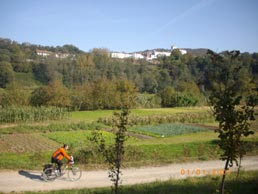
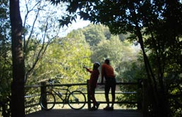 After we have travelled a short way alongside the river, on our side the valley once again opens out into a broad and flat water meadow (Km 35.4) and river and Greenway separate once more. As on the previous occasion, in between the two a flat alluvial strip remains where corn and market garden crops are grown. On the opposite bank, to our right, the high mountains give way to rolling hills on which is sited the village of Biriatou. White houses with red wooden shutters, presided over by a church and a pelota court can be seen above the leafy riparian forest that lines the river. After we have travelled a short way alongside the river, on our side the valley once again opens out into a broad and flat water meadow (Km 35.4) and river and Greenway separate once more. As on the previous occasion, in between the two a flat alluvial strip remains where corn and market garden crops are grown. On the opposite bank, to our right, the high mountains give way to rolling hills on which is sited the village of Biriatou. White houses with red wooden shutters, presided over by a church and a pelota court can be seen above the leafy riparian forest that lines the river.
At the end of this meadowland (Km 36.5), a new sharp turn to the right causes the cutbanks to be on our side and the point bars to be on the French side. The Greenway, now hemmed in by the valley side, is now cut into the slop one ‘step’ below the road and one ‘step’ above the river. With the stone embankment carrying the road on our left hand side, our views are once again limited to the French side of the river, where cropland and pasture land is dotted with country houses.
Km 37,3
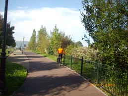
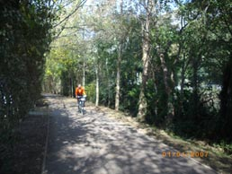 The Bidasoa Greenway climbs up to the level of the road and arrives at a large roundabout with accesses to the Puntta service station and the Zaisa industrial estate. Our journey through the countryside is over and we enter the town of Irun. The final section of the Bidasoa railway has been devoured by urban development and roads. Given that following the original route of the railway is no longer an option, we take the riverside path which runs around the Irun Transportation Hub. Contrary to what you might expect, warehouses, docks and hundreds of trucks are hidden by a screen of vegetation. The Bidasoa Greenway climbs up to the level of the road and arrives at a large roundabout with accesses to the Puntta service station and the Zaisa industrial estate. Our journey through the countryside is over and we enter the town of Irun. The final section of the Bidasoa railway has been devoured by urban development and roads. Given that following the original route of the railway is no longer an option, we take the riverside path which runs around the Irun Transportation Hub. Contrary to what you might expect, warehouses, docks and hundreds of trucks are hidden by a screen of vegetation.
Now immersed in a riverside tunnel of dense tree and plant life, the Greenway becomes even greener. It is now a tarmacked and well lit promenade punctuated by places to fish from. With their conveniently sited benches these fishing spots make attractive viewing points from which to contemplate the placid, and now tidal, river with its green tinted rocky bed.
Emerging from our leafy tunnel we pass under the bridge carrying the A-8 motorway and arrive at the Pausu Bridge (Km 38.6). This bridge connects the two neighbouring countries and links Behobia with its French opposite number on the opposite bank. This could be the end of our route, but the cycle path continues onwards for a few more metres downstream, through the gardens near the Alcaldía de Sacas, a small customs office which was in operation until midway through the 19th century. The Bidasoa Greenway ends definitively near the Isla de los Faisanes (Isle of Pheasants, Km 39), an island sited in the middle of the Bidasoa river which, since the Pyrenees pact, has belonged for six months of every year by the Spanish and for the other six months by the French.
 Between Behobia and the link with the Ferrocarril del Norte every trace of the Bidasoa railway has disappeared. Nothing remains of the stations of Irun-Town, situated next to the Paseo Colón bridge, Irun-Bidasoa or Mendibil in Kostorbe, where the workshops and engine sheds were located, or Arteaga, built expressly as an unloading terminal for the mining train which original belonged to the French company, Mines de Bidassoa. Between Behobia and the link with the Ferrocarril del Norte every trace of the Bidasoa railway has disappeared. Nothing remains of the stations of Irun-Town, situated next to the Paseo Colón bridge, Irun-Bidasoa or Mendibil in Kostorbe, where the workshops and engine sheds were located, or Arteaga, built expressly as an unloading terminal for the mining train which original belonged to the French company, Mines de Bidassoa.
An interesting aside: The French engineer Emilio Ferier built a complex system of mountain railways, inclined planes and aerial cableways to transport siderite extracted from the Meazuri, Meagorri, Aitzondo and Basakaitz mines to the calcining kilns at Irugurutzeta. The Irun town council has restored what is, without a doubt, the largest group of kilns in the Basque Country, and is planning to open an Interpretation Space for the Irugurutzeta Mining Area in what is now the silo/storehouse building. Practically the entire route of the old “French train” has been converted into cycle paths. From the Artia area we can arrive on foot or by bike to the calcining kilns. Precisely part of this route is the one used by the Tren Verde (Green Train) to reach the kilns and offer monitored visits around the complex. The train leaves from Irun every Sunday in the spring and summer.
 When we arrive at the outskirts of Irun it is no longer possible to follow the original path of the railway, so instead we take the Camino de la Bahía towards the Pausu bridge. Here we link up with the 14 km cycle path which runs through the French town of Hendaye and the Guipúzcoan towns of Irun and Hondarribia/Fuenterrabía. It starts at the Chateau D'Abbadie in Hendaye and reaches the Higer lighthouse in Hondarribia/Fuenterrabía, after running around both sides of the Bidasoa-Txingudi bay. When we arrive at the outskirts of Irun it is no longer possible to follow the original path of the railway, so instead we take the Camino de la Bahía towards the Pausu bridge. Here we link up with the 14 km cycle path which runs through the French town of Hendaye and the Guipúzcoan towns of Irun and Hondarribia/Fuenterrabía. It starts at the Chateau D'Abbadie in Hendaye and reaches the Higer lighthouse in Hondarribia/Fuenterrabía, after running around both sides of the Bidasoa-Txingudi bay.
The town of Hondarribia/Fuenterrabía has a beach and a magnificent historic town centre. From here we can climb the infernally steep slope up Mount Jaizkibel. At the top there are several watchtowers which now serve as viewing points from where, on days without mist, we can enjoy an exceptional view of the mouth of the river. A superb end to our journey.
At the Pausu bridge we can also link up with the Eurovelo 1 route. The European project known as Eurovelo is a network with 12 long distance routes which enable users to cycle across Europe. Eurovelo 1 or the Atlantic Coast Route, between Norway and Portugal, will enter Spain at Irun to link up with the Way of St James in Navarre. The initial work on Eurovelo 1, scheduled for 2011 and 2012, will consolidate the section between the French village of Guethary and the Navarre town of Doneztebe/Santesteban, making use of part of the Bidasoa Greenway. The route will also make use of the landmark customs building in Irun. It will be refurbished as an interpretation centre offering information about the Eurovelo 1 route itself, the Atlantic Pyrenees (a French department), Guipúzcoa and Navarre. As a result of the preliminary work carried out on Eurovelo 1, the Bidasoa Greenway will be significantly improved between Irun and Doneztebe/Santesteban.
After the work scheduled for 2016-2019 as part of the Ederbidea project, the Bidasoa Greenway will link up with the Plazaola Greenway by means of a new section running between Doneztebe/Santesteban and Urritza, passing through Saldias and Jauntsarats.
|
