Km 0
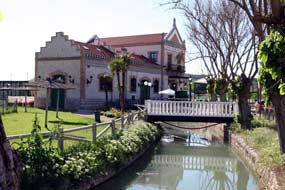
 There are two ways to get to the start of the 40 Day Train Greenway, developed by the Autonomous Community of Madrid. One on foot, by bike, or by wheelchair from the Tajuña Greenway, which forms a continuation of the 40 Day Train Greenway (together they total 63 kilometres). The other way to arrive is from Carabaña, a rural town famous for its medicinal waters. Beside the M 204 road you can still see the remains of the various facilities that grew up around the saline springs: the baths, the bottling plant (now a youth hostel), and the attractive Chávarri electricity plant built on what was once a flour mill. As we leave Carabaña, about 200 m from the town centre the road which goes to Estremera crosses the river Tajuña over a historic 16th century bridge and, immediately afterwards, also crosses the Tajuña Greenway. We join this Greenway (on our left) and 300 m further on the red tarmac identifying the trail divides. The left hand lane, belonging to the Tajuña Greenway, continues to make its way through the Tajuña river lowlands as far as Ambite, while the right hand lane, part of the 40 Day Train Greenway, starts to climb. Halfway up, the trail turns sharply to the right and joins the original route of the 40 Day Railway.
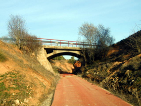
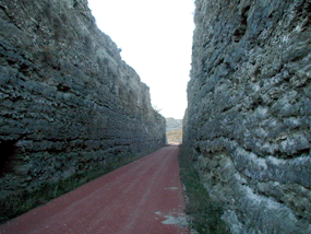
 Climbing upwards, our Greenway makes its way along the mountainous slopes which confine the Carrizales stream, whose scant (sometimes non-existent) waters, bordered by reed beds and deciduous trees, wind between small plots of land planted with cereals, vines and vegetables. We are in an area of rugged, solitary beauty, a landscape ever awaiting spring when it can show itself off in its best light and surprise us with its aromas and flowers. In order to make headway over such a difficult terrain, it was necessary to dig a series of cuttings which cleave the hills of soft marl, limestone, clay or gypsum, revealing their multicoloured layers. And on a sunny day you might want to hold out your hand to catch the sun glinting off the mirrors of crystallized gypsum in the cuttings.
Km 4
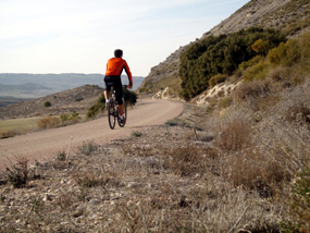
And as if that wasn’t enough, the birds nesting in these cuttings take flight at dusk, offering walkers and cyclists a spectacular sight. When the silhouette of the San Juan Bautista Church (km 3,5) comes into view on the horizon, the Greenway meets the M 221 road to Valdaracete. and runs parallel to it for a short time. At km 4.5 the road takes its leave of the Greenway and we return to the peace and quiet of before. From here the red trail continues to ascend the Carrizales stream lowlands, now broad and gently rolling and mostly under the plough for cereals, but dotted here and there with pine and oak groves. The only movement comes from partridges and rabbits.
Km 7
 At the underpass under the M 221 road (km 7) we reach the end of the Carrizales stream lowlands. Here the incline, too steep to be tackled directly, forces the railway to make a 180º turn, taking our route out of the lowlands and into an open landscape dominated by cereal crops. At a strategic halfway point we reach the rest area (km 8.2) where the road to Valdaracete, the Greenway, and the Cañada Real Soriana Oriental, a drovers’ road where there are a number of information boards, all meet. After the rest area the route passes through a cutting dug into reddish clay. In this cutting we finally pass over the watershed between the Tajuña valley and the river Tajo basin; we switch from the tributary to the mainstem river, and from climbing to descending.
Km 12
The rolling countryside which drops down into the Tajo basin takes us to an olive grove which stretches as far as the town of Valdaracete, whose name comes from the Arabic Val Dar Az-Záit, meaning “valley of the house of olive oil”. At km 12 the trail reaches the M 221 road. The original route of the railway, which we never regain, crosses the tarmac and becomes a rural track. Meanwhile, the Greenway itself continues to lose height as it runs alongside the road between olive groves and dryland crops. Two kilometres further down (km 14), the Greenway reaches its end in the town of Estremera, very close to the regional border with the Castilla La Mancha Autonomous Community.

