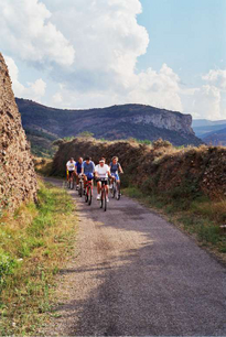
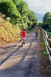
Informative signposting, some new purpose-built bridges, and a good quality surface will help everyone enjoy this journey along Oja Valley to the Sierra de la Demanda.
Km 0
 The route begins at the railway station at Casalarreina, Km 0 of our Greenway. To find the station we need to go to the crossroads formed by the N232 (as it passes through the town) and the Zarrat ón road (the LR-311). The Greenway uses this latter road for some 300 metres until rejoining the railway line outside the town at a level crossing. Here we turn right onto a seemingly endless straight.
However , there is a possible new proposal from July 2016.
From the begining of the greenway it can be continued to Haro by the so-called "Green Route Oja – Tirón”. A total of 12 kilometers in addition to the 26 Greenway to offer 38 kilometers followed by "safe and signposted” route through the valley of the Oja.
If you choose this stretch also need to know that the trail starts about 2 kilometers from the village of Casalarreina, just where the Greenway ends, and passes under the roundabouts.
Parallel to the river, proceeds a section along the riverside town park and arriving at the Oja River walkway the route changes margin and continues along the left bank of the Oja, through a riparian forest. Along the way there are several points where you can leave the trail and access to the interior of these groves and the riverbeditself. Among cereal fields, orchards and vineyards the route reaches Cihuri, Basque origin place-name meaning 'Villa del Puente' in honor of the bridge Priory, and framed by the silhouette of the Obarenes mountains and crags of Gembres.
The next stop of the Green Route is Anguciana and then Haro, which ends at the Park Vista Alegre, in the urban area of the municipality.
But let´s follow the Greenway from Casalarrein....
Km 4,5
After a section where poplar trees line the route on either side, at Km 4.5 we reach Castañares station. From here we continue in a dead straight line between crop fields but without the benefit of any trees to give us a little shade. Half way along this straight section, at Km 6, the route crosses the Najerilla canal before approaching the outskirts of Bañares, at Km 6.5.
Some 300 metres previously we will have encountered two intersections, one with the Bañares road and another, of greater historical importance, with an old Roman road that used to be part of the original Camino de Santiago before it was diverted southwards in the 12th century to pass through Santo Domingo de la Calzada.
Km 11
 Soon after passing a level crossing with the Bañares to Santo Domingo road, at Km 13 we reach the main Santo Domingo de la Calzada bypass (the N 120) which we cross by means of an underpass. If we wish to pay a visit to the splendid historical city of Santo Domingo de la Calzada we can take a right turn (next to the old La Feculera potato starch factory) down a tree lined rural track which will eventually take us to the Plaza Mayor de Santo Domingo.
Returning to our Greenway, next to the bullring the old railway line has been absorbed by the road network of a new industrial estate. Our route, however, is well signposted and will take us to another intersection with the Zarratón road.
Km 19
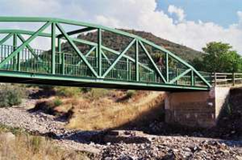
At Km 18.5 we cross the Arroyo de Santurdejo by a bridge rebuilt specifically for the Rio Oja Greenway after the original railway bridge was swept away one historic day when the normally dry watercourse turned into a torrent. Just the other side of the bridge is what remains of the Santurde-Santurdejo station, which is halfway between the two villages that give it its name (Km 19).
Up to now the route has been mainly dead straight, but after Santurdejo we begin a twisting climb up to Monte Bellifera. Deciduous woods carpet the neighbouring hillsides as we rise above the course of the River Oja.
At Km 21 we pass through the village of San Asensio de los Cantos where a new bridge has been built over the Arroyo de San Asensio.
Km 24
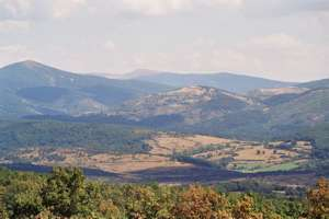
We continue to climb easily towards Ojacastro and its railway station, now used as retreat by a community of nuns. From here there is a magnificent view of the River Oja, the woods along its banks, the Sierra de la Demanda mountains and, most especially, the Peña de San Torcuato, a rocky spur which dominates the final stage of the old Ezcaray railway.
Km 28
 The railway leaves the station over a bridge and sets off towards the Peña de San Torcuato. The trail twists and turns as it climbs up the mountainside, sometimes plunging into cuttings and other times rising up on embankments. It is without question the most scenic part of the entire Greenway.
At Km 28 we arrive at Ezcaray station, now restored as a restaurant with a terrace which the weary traveller can enter from the same street that leads to the hermitage of Nuestra Señora de Allende, patron saint of the town. Ezcaray is a major tourist centre, very close to the Sierra de la Demanda, featuring impeccable casas blasonadas (houses with stone heraldic devices on their facades) and a spectacular Gothic-style church.
If this 28 km route has left you wanting more, you can extend it a little by adding on the GR 93 hiking trail which goes from Ezcaray to the monastery of San Millán de la Cogolla.

