|
 Back to index Back to index
|
| Itineraries > Mutiloa-Ormaiztegi Greenway |
| Mutiloa-Ormaiztegi Greenway |
|
|
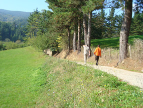
This Greenway, based on a mining railway, is strictly mountainous. It runs high up in the Goierri, hugging the rocky hillsides, far above the towns and villages mentioned en route.
Its beauty lies in the panoramic views of the valleys which lie at its feet and the forestry which surrounds it.
There is an orientation game suitable for families and children. You can pick the map in the Zumalakarregi museum in Ormaiztegi."
This Greenway has been carried out by the Basque Government (Department of Industry and Mines).
|
|
|
| WRITE YOUR REVIEW
|
| Technical Data
|
|
 CONDITIONED GREENWAY CONDITIONED GREENWAY
|
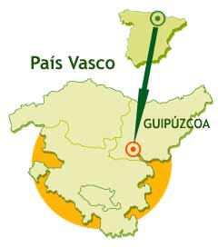
Through the rural district of Goierri, the Guipuzcoan highlands
LOCATION
Between the Barnaola or Barrenola country houses (Mutiloa) and the Lointzi hillside (Ormaiztegi)
GIPUZKOA
Length: 4,5 Km. By adding the Troi path (Troi bidea) or the access to it the Greenway from Mutiloa it is 1.9 km longer
Users:    * *
* Greenway suitable for all users but with difficulties in the Troi path section: the first half is shared with motor traffic while the second half has some very steep slopes. The accesses at Liernia and Ormaiztegi are recommended
|
|
 |
|
Type of Surface:
ATarmac (first 400 m) and compacted earth
Natural Settings:
Goierri mountains. Pine and broadleaf forests. Valleys of the Troi and Estanda streams. Mount Mugata-La Española
Cultural heritage:
Mutiloa: Mutiloa mining district, Liernia chapel, Church of San Miguel Arcángel, and Errotatxo (water mill)
Ormaiztegi: Iron viaduct over the Estanda stream (Madrid-Irún line), Zumalacárregui Museum in the Iriarte Erdikoa country house, Church of San Andrés (Visigothic font)
Zerain: Montaña del Hierro, Larraondo sawmill, prison dating from 1711, ethnographic museum, Church of La Asunción, Jauregi Palace, San Blas chapel, bowls court, and demonstrations of how cheese and honey are made
Infraestructure:
Greenway. One bridge, one pedestrian overpass, and one ruined engine shed (Makinetxe). Short section with rails. Liernia recreational area with benches, tables, and a water fountain. Kilometre stones, signposts and information panels
How to get there:
Mutiloa
Bus/Coach. Goierrialdea Autobusak. Line 4B (Mutiloa-Beasain)
Ormaiztegi
Bus/Coach. Goierrialdea Autobusak. Legorreta-Zumárraga lines. Pesa. Bilbao-Zumárraga-San Sebastián and Eibar-Pamplona lines
Railway. Suburban network. San Sebastián/Donostia-Brinkola line
Zerain
Bus/Coach. Goierrialdea Autobusak. Line 4B (Mutiloa-Beasain)
Connections:
Bilbao: 85 km from Mutiloa
Donostia/San Sebastián: 60 km from Mutiloa
Complete map:
.JPG)
|
|
|
|
| Description
|
|
|
|
The origins of the former railway line are the mining districts of Mutiloa and Zerain. The route through the countryside is made all the more pleasurable and enlightening by a visit to the Mining Interpretation Centre, to the three large calcining kilns, and to a mining gallery at Montaña del Hierro, Zerain.
The rural district of Goierri also offers visitors the chance to try Idiazabal cheese, the Aralar and Aizkorri-Aratz natural parks, villages of a truly rural flavour, and the heritage sites of Segura, Ordicia and Igartza (Beasain).
Km 0
 The Mutiloa-Ormaiztegi Greenway developed by the Department of Industry and Mining of the Basque Government is strictly mountainous. It hugs the rocky hillsides, far away from and far above the towns and villages mentioned en route. However, such a wild and lofty scenario has a drawback, or an advantage, depending on how you look at it: at the Barnaola or Barrenola country house, from where the route sets off, there is no proper space for parking. There is a very pretty access path, but one which is quite demanding physically since it never was, nor is it as flat as, a railway track bed. Even so, it is probably the best option. The steep Troi path (Troi bidea) climbs from the village of Mutiloa to the Barnaola country house alongside the lively Troi stream (Troi erreka), to the delight of mountain trail fans. The Mutiloa-Ormaiztegi Greenway developed by the Department of Industry and Mining of the Basque Government is strictly mountainous. It hugs the rocky hillsides, far away from and far above the towns and villages mentioned en route. However, such a wild and lofty scenario has a drawback, or an advantage, depending on how you look at it: at the Barnaola or Barrenola country house, from where the route sets off, there is no proper space for parking. There is a very pretty access path, but one which is quite demanding physically since it never was, nor is it as flat as, a railway track bed. Even so, it is probably the best option. The steep Troi path (Troi bidea) climbs from the village of Mutiloa to the Barnaola country house alongside the lively Troi stream (Troi erreka), to the delight of mountain trail fans.
However, those wishing to access the route by car have two options. From the village of Ormaiztegi, a tarmacked and signposted track climbs to the end of the Greenway. And at the mid-point of the route, at the Liernia country house, the Greenway and the Mutiloa-Ormaiztegi meet.
 On arriving at the small and tranquil village of Mutiloa, the road from Ormaiztegi (GI 3572) meets a T-junction. A short way along, the road to the right forks, with one road going to Zerain and the other to Segura. The right hand fork passes by an outstanding church and takes us to a tarmacked track which climbs up the Troi valley to Barnaola. Although a sign warns us that it is not a through road, the GI 4571 road provides access to the hamlets of Lenkaran and Ergoena, the latter of which is home to the Barnaola country house. On arriving at the small and tranquil village of Mutiloa, the road from Ormaiztegi (GI 3572) meets a T-junction. A short way along, the road to the right forks, with one road going to Zerain and the other to Segura. The right hand fork passes by an outstanding church and takes us to a tarmacked track which climbs up the Troi valley to Barnaola. Although a sign warns us that it is not a through road, the GI 4571 road provides access to the hamlets of Lenkaran and Ergoena, the latter of which is home to the Barnaola country house.
From Mutiloa along the Troi Bidea. It is possible to park in the village square in front of the church. From here, either on two wheels or on foot, we head off up the tarmacked path that goes to Barnaola. The Troi path up to Barnaola has two very different parts. For the first half of the climb we share the tarmacked road with motor traffic, albeit hardly any. This road climbs boldly between hillsides of green pastureland dotted here and there with large country houses. In the pastures it is common to see Latxa sheep, a breed which abounds in the Aralar and Aizkorri area. This breed, indigenous to the Basque country, yields a milk from which delicious cheeses are made, including Roncal and Idiazábal. This Greenway takes us close to the town of Idiazábal, which gives its name to the Idiazabal Protected Designation of Origin, and where we can visit the Idiazabal Cheese Interpretation and Tasting Centre.
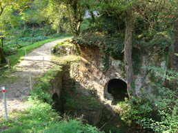
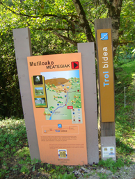
Half way up the climb to Barnaola, a path leads off from the road to our left, and we abandon the comfortable tarmac surface. You cannot miss the turn-off. Where the path turns off there are old stone mills with their feet in the water and a bridge over the crystalline waters. Also, a timely information panel on the Troi Bidea makes any wrong turning impossible. On the far side of the river a steep concreted slope climbs high above the stream, from where we can enjoy some vertiginous views from behind the conveniently placed protective railings. Then immediately afterwards the concrete path plunges downwards just as steeply back to the level of the stream again.
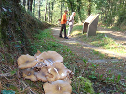 After this short but gruelling switchback section comes the reward. Once we are back alongside the stream, the next section of the Troi path is one of the most beautiful of the entire excursion. The Greenway moves away from the road and enters the forest where the dense treetops throw the trail into semi-darkness. The atmosphere is permeated with the shady dampness of the river and the lush green of moss and ferns. The babbling current runs sparkling and joyful in the valley below. Autumn turns the lush summer greens into ochre tones. The setting lifts our spirits and eases the mountainous climb. After this short but gruelling switchback section comes the reward. Once we are back alongside the stream, the next section of the Troi path is one of the most beautiful of the entire excursion. The Greenway moves away from the road and enters the forest where the dense treetops throw the trail into semi-darkness. The atmosphere is permeated with the shady dampness of the river and the lush green of moss and ferns. The babbling current runs sparkling and joyful in the valley below. Autumn turns the lush summer greens into ochre tones. The setting lifts our spirits and eases the mountainous climb.
The first signs of the mining activity which spawned the railway appear towards the end of this path. In the depths of the valley we can see a succession of high, thick masonry walls. These are the dikes of the settling ponds, built to contain the mining effluent at Troi.
The Troi path and its hard climb come to an end at the Barnaola country house, where the mineral ore from the Mutiloa and Cerain Iron Ore mining companies used to arrive prior to being loaded onto trains and carried away. And where now the Mutiloa–Ormaitzegi Greenway starts.
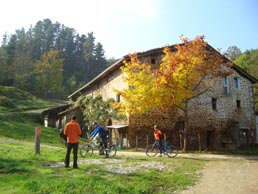 The old mining and processing areas of the Mutiloa mining district extend up the steep slopes of mount Aizpuru, above the Barnaola country house. Evidence of the area’s mining past is clear to see in the hillside laid bare of trees, with the slagheaps and stripped land giving rise to a lunar landscape. The most important mining area was Peatza, on either side of the road between Zerain and Legazpi. In the processing area, lower down beside the Monastegizar country house, are the remains of the slag heap, the water tank, the iron ore store and the ore washing facility. Close by the Barnaola country house is the company’s headquarters, and the remains of an old mineral ore loading facility can still be seen, along with a large unloading hopper. The path which sets off from the left hand side of the Barnaola country house climbs up towards this complex, a paradise for lovers of mining history. A signpost pointing to Monastegizar Peatza will help those interested find their way. The old mining and processing areas of the Mutiloa mining district extend up the steep slopes of mount Aizpuru, above the Barnaola country house. Evidence of the area’s mining past is clear to see in the hillside laid bare of trees, with the slagheaps and stripped land giving rise to a lunar landscape. The most important mining area was Peatza, on either side of the road between Zerain and Legazpi. In the processing area, lower down beside the Monastegizar country house, are the remains of the slag heap, the water tank, the iron ore store and the ore washing facility. Close by the Barnaola country house is the company’s headquarters, and the remains of an old mineral ore loading facility can still be seen, along with a large unloading hopper. The path which sets off from the left hand side of the Barnaola country house climbs up towards this complex, a paradise for lovers of mining history. A signpost pointing to Monastegizar Peatza will help those interested find their way.
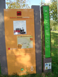 The Mutiloa-Ormaitzegi Greenway (Mutiloako bide berdea) proper starts at Barnaola. On the right a flat, tarmacked track runs from the country house to the local road coming from Mutiloa. Travelling now along the old track bed of the Mutiloa mining railway (Mutiloako Meatze Trenbidea), we soon come to a gate, which we will close behind us, and a crossing over the road. After the crossing the Greenway continues, now with a surface of compacted earth, past the ruins of an engine shed (Makinetxe) and, a little further on, a bridge in a similar state of repair. The Mutiloa-Ormaitzegi Greenway (Mutiloako bide berdea) proper starts at Barnaola. On the right a flat, tarmacked track runs from the country house to the local road coming from Mutiloa. Travelling now along the old track bed of the Mutiloa mining railway (Mutiloako Meatze Trenbidea), we soon come to a gate, which we will close behind us, and a crossing over the road. After the crossing the Greenway continues, now with a surface of compacted earth, past the ruins of an engine shed (Makinetxe) and, a little further on, a bridge in a similar state of repair.
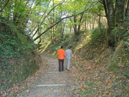
The first section of our route runs along a terrace cut into the sunny or south side of Mount Izturi, providing magnificent panoramic views of the Troi valley and Mutiloa. For this entire section we travel under a leafy canopy of trees. In this area the pine is the most common tree, but some oaks, black locusts and other broadleaf trees have sneaked in to provide ochre tones in autumn.
The ruined bridge at Potxueta used to span a narrow but deep cutting. On the northern hillside the view is of a broader valley covered with meadows, through which the road to Zumárraga and the Estanda stream both run. Our Greenway now begins to descend gently, still shaded by a tunnel of leafy trees.
Km 2,5
At the natural pass through the Liernia hills (km 2.5) the Greenway crosses the Mutiloa-Ormaiztegi road (GI 3572). The pass opens out providing magnificent views of the Burdas valley and the village of Ormaiztegi (to our left), and the Troi valley and beyond. Above Mutiloa, to our right, rears up the silhouette of the impressive Aizkorri mountain range and the peak of the same name. This is the second highest peak in Gipuzkoa, a bare 16 metres lower than Aketegi (1,544 m). It is obvious why this rural district, Goierri, home to highest peaks in the Basque Country (Euskadi), is referred to as the highlands of Gipuzkoa. It is also home to two exceptional natural parks: Aizkorri-Aratz and Aralar.
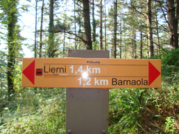 The Liernia pass is also strategic from the point of view of taking refreshments. After the crossing there is a direct access to a rest area and the village of Liernia, where there is a restaurant, a rural hotel, a chapel, and several country houses. The Liernia pass is also strategic from the point of view of taking refreshments. After the crossing there is a direct access to a rest area and the village of Liernia, where there is a restaurant, a rural hotel, a chapel, and several country houses.
Some metres away is the Liernia bridge (Lierniako Zubia), where some rails have been left in place as testament to the fact that this route started out as a railway line.
After the bridge, the Greenway continues its gradual descent down Mount Mugata-La Española. During the Carlist wars and the Civil War a defensive system was built on Mount La Española, whose strategic position controlled the adjacent valleys. Here, close to the Zelaundieta country house, Carlist General Tomás Zumalacárregui successfully fought one his greatest battles, in which he held up the troops of Carratalá, Espartero, Lorenzo and Jauregi.
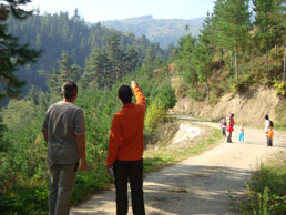 Today those dramatic scenes at Mount La Española are forgotten as we enter one of the prettiest sections of the Greenway. The railway track bed, cut into a steep hillside, twists and turns at the tune of the mountainous topography. A dense pine forest envelops the winding railway route, cutting off all views. Further on the dense pine forest is reinforced with broadleaf varieties (oak, chestnut, yellow birch, and holly) which provide ochre tones in the autumn. Today those dramatic scenes at Mount La Española are forgotten as we enter one of the prettiest sections of the Greenway. The railway track bed, cut into a steep hillside, twists and turns at the tune of the mountainous topography. A dense pine forest envelops the winding railway route, cutting off all views. Further on the dense pine forest is reinforced with broadleaf varieties (oak, chestnut, yellow birch, and holly) which provide ochre tones in the autumn.
A little further on the view opens out to include the Estanda valley, the lofty Gabiriaque country house, and the two railway viaducts at Ormaiztegi. A note on these magnificent engineering works: The old iron viaduct (1864) was built by Alexandre Lavalley, a predecessor of Gustave Eiffel. This engineer was able to build a wide, uncluttered, light very safe bridge thanks to his masterful use of iron, a building material had not long been used for building bridges and which was to revolutionize bridge-building due to the possibilities it offered. The strategic value of the viaduct was enormous, and its worst enemy was war. During the Spanish Civil War workers at Altos Hornos de Bergara cut the bridge with blow torches to prevent the advance of National troops. Franco’s troops arrived the next day and shot the workers against the cemetery wall near the bridge. In 1941 it was rebuilt and strengthened with concrete pillars which we can still see today. After 131 years of continual use, during which time railway traffic grew one hundredfold over what was expected at the time of its construction, in 1995 a new concrete bridge was built.
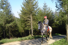 Finally our Greenway splits into two short spurs. The section on the right, still with its rails in place, ends at a clearing. The left hand spur ends at the tarmacked track which leads down to Ormaiztegi. Here the mining companies’ railways separated, leaving a blind track in the middle. The Cerain Iron Ore Company went to the right and the Compañía Minera de Mutiloa to the left. Each company’s railway headed off to its facilities lower down the hillside. The journey ended with the ore being unloaded at its respective areas of processing and dispatch on the Damborre and Lointzi hillsides, where there are inclined planes, stores, calcining kilns, aerial cableways and tracks; an industrial complex for which recovery plans are being prepared. The mining process concluded with the transfer of the ore to Ferrocarril del Norte trains at Ormaiztegi station. From there it was taken to the port at Pasajes/Pasaia where it would be loaded on ships bound for England. Finally our Greenway splits into two short spurs. The section on the right, still with its rails in place, ends at a clearing. The left hand spur ends at the tarmacked track which leads down to Ormaiztegi. Here the mining companies’ railways separated, leaving a blind track in the middle. The Cerain Iron Ore Company went to the right and the Compañía Minera de Mutiloa to the left. Each company’s railway headed off to its facilities lower down the hillside. The journey ended with the ore being unloaded at its respective areas of processing and dispatch on the Damborre and Lointzi hillsides, where there are inclined planes, stores, calcining kilns, aerial cableways and tracks; an industrial complex for which recovery plans are being prepared. The mining process concluded with the transfer of the ore to Ferrocarril del Norte trains at Ormaiztegi station. From there it was taken to the port at Pasajes/Pasaia where it would be loaded on ships bound for England.
Although outside the scope of our modest mining railway, Greenway users could do worse than to make a detour down the tarmacked track leading to Ormaiztegi and stand under the two railway viaducts crossing the Estanda valley. The old iron viaduct of the Ferrocarril del Norte railway company is impressive for its size, technical features, and its history, without wishing to belittle the new concrete bridge, also a colossal feat of engineering. The two form a duo the equal of which would be hard to find.
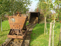 The excursion ends here, but to do justice to this route we should round it off with a visit to the Aizpea mining complex, in the municipality of Zerain. Mining operations at Montaña del Hierro in Zerain date from the distant past. However the complex of buildings and structures that we can see today is the legacy of its industrial exploitation early in the 20th century. At the village of Aizpea, three kilometres from Zerain, we can find the House of the English or House of the Engineers (built in 1900 to provide accommodation for the site engineer and accountant), the iron ore store, the coal store, three large calcining kilns used to purify the iron, and the mines themselves. Also conserved are the remains of the two railways which carried the ore to the kilns, and the two aerial tramways which used to transport the iron to the Barnaola country house (Mutiloa) and the Ormaztegi railway station. The excursion ends here, but to do justice to this route we should round it off with a visit to the Aizpea mining complex, in the municipality of Zerain. Mining operations at Montaña del Hierro in Zerain date from the distant past. However the complex of buildings and structures that we can see today is the legacy of its industrial exploitation early in the 20th century. At the village of Aizpea, three kilometres from Zerain, we can find the House of the English or House of the Engineers (built in 1900 to provide accommodation for the site engineer and accountant), the iron ore store, the coal store, three large calcining kilns used to purify the iron, and the mines themselves. Also conserved are the remains of the two railways which carried the ore to the kilns, and the two aerial tramways which used to transport the iron to the Barnaola country house (Mutiloa) and the Ormaztegi railway station.
Montaña del Hierro has been declared a Heritage Site and the area is currently the subject of a survey. The Aizpitta Mining Interpretation Centre was set up to disseminate the culture of iron in what is known as the House of the English: the first floor is home to an audiovisual presentation of the history of the mines and the lives of the local people. The ground floor explains the historical context and provides specific facts about the lives of the local people - for example, the number of workers and the wage they earned – via information panels and touch screens. The outing can be rounded off by a visit to the three big calcining kilns and a trip down the Polborina mine.
And if you liked the Greenway, don't miss out on the rest of the resources offered by the Goierri region. In this COMPLETE MAP>> you will find general information about the Goierri Mining Park, its 2 mining preserves and the 4 routes that can be done on foot or by bike and that connect the different mining areas: The Mutiloa - Ormaiztegi greenway and 3 other trails to get to know this special area. 15 km full of landscapes, culture and mining past through the highlands of the province of Gipuzkoa.
|
|
|
|
|
|
|
|
| Railway History
|
|
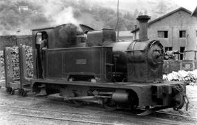 This is the history of two mining districts and one railway line. Two well-matched mining companies which worked on opposite sides of the same mountain and used the same train. From the Troi-Aztiria mines (Mutiloa mining district) the Compañía Minera de Mutiloa extracted hematites from placers (residual deposits) which were washed at Monastegizar, although a small vein of hematites with quite a lot of lime (iron carbonates) was also exploited and enriched by calcination in a kiln near Ormaiztegui station. This is the history of two mining districts and one railway line. Two well-matched mining companies which worked on opposite sides of the same mountain and used the same train. From the Troi-Aztiria mines (Mutiloa mining district) the Compañía Minera de Mutiloa extracted hematites from placers (residual deposits) which were washed at Monastegizar, although a small vein of hematites with quite a lot of lime (iron carbonates) was also exploited and enriched by calcination in a kiln near Ormaiztegui station.
In order to transport the ore to the processing plants, the Compañía Minera de Mutiloa decided to use mountain trains pulled by steam locomotives. The Mutiloa-Ormaiztegi railway started up in 1901 with two locomotives, with a total capacity of around 300 metric tons a day. The ore travelled down an inclined plane from the mining district to the Barnaola country house. There it was loaded onto the wagons and the Mutiloa railway carried it to Ormaiztegi station, where it was transferred onto the Ferrocarril del Norte trains.
The Cerain Iron Ore Company Limited extracted iron carbonates from the Aizpea mining district in Zerain, on the other side of the mountain which rises above the Barnaola country house. This British company built a mountain railway just 1.5 km long. A train pulled by a steam locomotive collected the ore extracted from the various mines and carried it in wagons to an inclined plane, where it travelled down to the calcining kilns at Aizpea. After the calcining process, an aerial tramway some 3 km long carried the ore to the Barnaola country house, where it was also loaded onto Mutiloa’s trains.
The two locomotives of the Mutiloa railway company, both called Mutiloa, ran for the last time in 1927. Here ends the history of the railway but not of the mines. The Troya mine at Mutiloa continued its operations until the 1980s. At Zerain, the mining operation was taken over by the German company, Aralar, in 1932 and the company Patricio Etxeberria of Legazpi prolonged its life from 1941 until its definitive closure in 1951.
|
|
|
|
|
| Links
|
|
Official Website of Tourism of the Basque Government.
Official Website of the Centers BTT Euskadi
Official site for hiking in Euskadi
Tourism Official Website of the Provincial Government of Gipuzkoa.
Official website for tourism in the Goierri
Article about the mines andminerals Zerain
Rural Tourism Accommodation
Mobility Portal of Public Transport in Gipuzkoa.
|
|
|
|
|
|
|
|
