|
This is a trip beside the river Oiartzun which takes us to the Arditurri mining district, right at the foot of mines first worked in Roman times, which last century spawned the railway line which our Greenway is based on today. This route has the added bonus of allowing us to go down into the actual mines. This underground walk through mines dating back nearly two thousand years is a memorable experience.
But first and foremost the Greenway, which follows the route of the old Arditurri mining railway, developed by the Provincial Government of Gipuzkoa, is the best way to see the rural district of Oarsoaldea in the province of Gipuzkoa.
The urban section of the old railway route has not been recovered for Greenway use. As an alternative we take a cycle path (or bidegorri as it is called in Basque) which, while it does not follow the old railway route exactly, at least starts out from where the old mining train used to finish its journey.
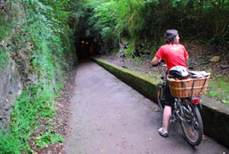
From the Renfe Suburban Line station at Pasai Antxo (Pasajes/Pasaia) we follow the cycle path which runs parallel to the old Madrid-Irún road (N-I/GI-2640), now the refurbished Avenida de Navarra. We now travel along the characteristic red tarmac of the cycle path, flanked on our right by the seafront facades of the town of Pasai Antxo and on our left by the salty aroma of the nearby docks, where the mineral ore carried by the Arditurri railway used to be loaded onto ships. It is highly recommended to make a stop in Pasaia and visit the Basque maritime factory Albaola, where a replica of the 16th century galleon San Juan is being built. Following the same maritime theme, we can also visit the eco-active ship-museum MATER (a traditional tuna boat that can be visited).
Once through Pasai Antxo we reach the big Molinao roundabout (km 0.3), the border between Pasaia and Errenteria, where our red cycle paths snakes upwards to reach the overpass which takes us over the access to the Errenteria suburb of Beraun. At the other end of the overpass the cycle path meets another one perpendicular to ours (km 0.5). At this T-junction we turn left and about 100 m further on we cross Sorgintxulo street (using a pedestrian crossing) and the cycle path begins to run parallel to the new A-I motorway, on our left. Once in Errenteria the cycle path parts company with the motorway and follows the old N-I road, which it crosses via a safe tunnel under the Capuchinos district of Errenteria, from which it emerges at the roundabout leading to the suburb of Alaberga (km 1.2).
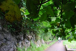
The other variant of this route starts in the municipality of Lezo, near a kiddies’ playground. The first stretch is made up of a two-way, marked and signedcycle path with an excellent surface, equipped with urban furniture, water fountains, waste paper bins and protective fencing.
After passing over the railway tracks, the cycle path arrives at the Lezo-Errenteria railway station. Nearby you can see a monument commemorating an old railway level crossing. Then our Greenway passes over a bridge crossing the river Oiartzun and joins the variant coming from Pasai Antxo described earlier.
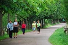
Now in the town proper of Errenteria, the cycle path runs alongside the route of the old N-I road formed by the Avenida de Navarra (Nafarroa Etorbidea) and its prolongation, Calle de los Amasa (Amasatarren Kalea). This section of cycle path continues to the banks of the river Oiartzun (km 2), a river which our Greenway will follow for many kilometres. The red cycle path follows the river upstream along Errenteria’s bustling riverside promenade, first flanked by the narrow mediaeval streets of its historic town centre, declared a heritage site and later by gardens and the groves of trees that provide cover to the riparian understory. The present day greenness dims the memory of the numerous factories which used to occupied this area some years ago and caused Errenteria to be dubbed “Little Manchester”. Here in Erreteria there are many places of interest that are well worth a visit. Such is the case of the Costume Centre (Jantziaren Zentroa), a museum that allows visitors to learn about the evolution of clothing over the centuries and to discover the history of fashion and the way of dressing in the Basque Country.
Another point of interest is the Fanderia Mill-River House, a building that bears witness to the strength and evolution of industry in Errenteria, nowadays converted into a river interpretation centre, and finally, the Fort of San Marcos, an old military fortress from the 19th century, nowadays converted into a museum and with a viewpoint from where you can see the eastern Basque Coast. A real delight!
At km 3.7 the cycle path says goodbye to Errenteria as, one after another, it passes under the Avenida de Fandería, the railway lines, and the A-8 motorway, before rounding it all off by crossing the river by a metal bridge. On the far bank, now in the municipality of Oiartzun, the route continues to follow the course of the river, taking us around the Talaia industrial estate and under the GI 2132 and GI 3631 roads via a couple of underpasses.
At the exit to the second of the underpasses, the Greenway cycle path meets another cycle path at a T-junction (Km 4.4). Here in the area called Larrea we must choose between two options: to our left there is a spur barely one kilometre long which runs along the rail bed of the old Artikutza railway to the village of Arragua and itsstation, while to our right the original route of the Arditurri railway makes a timely appearance. The entire rural section of the railway has been recovered and developed as a Greenway. At this junction there is an information panel about the Arditurri cycle path (Arditurriko Bidegorria) to clear up any doubts that users may have and to satisfy their curiosity.
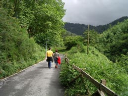
To our right, the Arditurri Greenway closely follows our travelling companion, the river Oiartzun, with its crystalline and babbling waters flowing between dense forestry. So much verdant freshness inebriates the senses while a curtain of trees and plant life screens us from the modern urbanity of the village of Ugaldetxo. Meanwhile, to our left we have an unbroken view of gently rolling hills covered with green meadows and woods, scattered with country houses. It is the idyllic image that you would expect to find in the rural Basque Country.
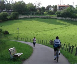
At around km 5.3, the Arditurri Greenway crosses the road going into Elizalde, passes a park overlooked by the bell tower of the church of San Esteban de Lartaun on our left, and splits into two before plunging into two parallel tunnels. Here we find incontrovertible proof that, in this section, the Arditurri mining railway ran parallel to the also disused Artikutza mining/timber railway. They ran alongside one another but were separate, which is why each railway had its own tunnel. This had a practical benefit for the developers of the Greenway; pedestrians and cyclists can be separated to prevent accidents in such narrow tunnels.
The short, well-lit underground stretch leads us to Txara de Mendibil, an area of oak and ash trees which used to be worked for timber. Next the trail cuts through a broad and flat carpet of green hay meadows, where the river and its tunnel of trees are left behind. In this open landscape the most striking feature is the rows of trees that flank the tarmacked cycle path. Each tree is properly identified with its respective label, providing us with a shady, open-air encyclopaedia of nature. The arboretum boasts over a hundred species: from the most primitive of trees, the yellow poplar, through magnolias, laurels and plain trees, to the blue holly, the most highly evolved plant.
However, this section has much more to offer. Half way along the tree-lined promenade, the Greenway crosses the road which leads down to Iturriotz (Km 6.4), a village featuring the fortified houses of Iturriotz and Makutso. And almost at the end of the botanical promenade (Km 6.6) there is a rest area with toilets, a water fountain and benches, from where the road to Elizalde leads off. The climb to Elizalde, the largest town in the municipality of Oiartzun, is energy sapping, but a stroll around the old town area makes the effort worthwhile
The tree-lined promenade comes to an end when the Greenway crosses the road at Altzibar (Km 7). Here we have the chance to make another break in our journey and visit this secluded village where in days gone by the river Oiartzun used to turn the wheel of the Ugarte mill.
After the botanical promenade, the trail continues through green meadows until it meets a small road leading to Altzibar and the GI 3420 road (Km 8). Here we can find some strategically placed restaurants, worthy ambassadors of Basque gastronomy, where we can put back some of the energy we have expended. The route crosses both roads without the benefit of bridge or tunnel before continuing parallel to the GI 3420 road, immersed in a landscape of pasture land and scattered country houses. Soon we reach the village of Ergoien (Km 9), where we can visit the Popular Music Centre and the Luberri Geological Interpretation Centre.
Km 9
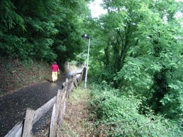 Once past Ergoien the landscape undergoes a radical change as we enter the natural exuberance of the Aiako Harria (Peñas de Aia)Natural Parkthrough a narrow gorge, hemmed in by steep, rocky slopes. Once past Ergoien the landscape undergoes a radical change as we enter the natural exuberance of the Aiako Harria (Peñas de Aia)Natural Parkthrough a narrow gorge, hemmed in by steep, rocky slopes.
The Arditurri Greenway now runs some way above the river Oiartzun, perched on a terrace cut into the hillside like a balcony over the river, which is now hidden by a tangled mass of verdant vegetation. In order to follow the river the track bed begins to climb more steeply, first in a straight line but then snaking up the abundantly lush green hillside.
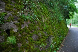
At around km 10.3 the trail arrives at another tunnel, the first of a long series of tunnels. It also forsakes the river Oiartzun for the river Arditurri, which runs through a gorge even narrower than the previous one. The beautiful setting becomes so wild that the track bed has to twist and turn to overcome the complicated topography. And when that was not enough, a long cutting was excavated, which time has lined with moss, and no fewer than four tunnels of varying lengths were bored to pass through the most obstinate rocky obstacles. The tunnels lend a cool and cavernous feel to the route, especially the last of them, which is very long and curves round. With some magnificent views of the vertical granite walls of the Aiako Harria (Peñas de Aia) crags to our front,our Greenway reaches its end at the Arditurri mining district (12 km).
The old mining laboratory building has been refurbished as an Interpretation Centre for the Aiako Harria Natural Park and the Arditurri Mines. Here we can learn about the historical, cultural and natural wealth of the Natural Park, home to the Arditurri mineral mines. The ground floor is devoted to the natural park while the first floor deals with the mining operation.
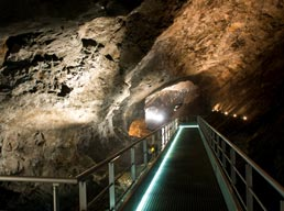
The cherry on the cake of our excursion is a descent into the heart of the Arditurri mines. The guided tour starts in gallery 20 or the Mina Grande. where we will need to put on a mining helmet. The explanations by the guide will be accompanied by sound and lighting effects.
There is another type of visit called “La mina a fondo” (Mining at depth in which you can visit another mine gallery at a lower level.
|
