| Ruta de la Plata Greenway (Salamanca.-Alba.de.Tormes) |
|

|
This greenway runs along the route of a disused railway line between Plasencia and Astorga.
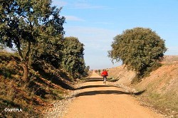
The 20.2 km long La Plata Greenway starts on the left bank of the River Tormes, very near the Natura 2000 network area “Riberas del río Tormes y Afluentes" (Banks and tributaries of the River Tormes), before heading off in a north-westerly direction towards the town of Carbajosa de la Sagrada, just 4 km from the city of Salamanca.
This Natural Way - Greenway has been implemented within the framework of the Natural Ways Programme of the Ministerio de Agricultura, Alimentación y Medio Natural. More info>>
|
| WRITE YOUR REVIEW
|
| Technical data
|
|
 CONDITIONED GREENWAY CONDITIONED GREENWAY
LOCATION
Through the charro field through the old Plasencia-Astorga railway line.
Municipalities: Carbajosa de la Sagrada, Arapiles, Calvarrasa de Arriba, Terradillos and Alba de Tormes.
Salamanca. Castilla y León.
Length: 20,2 km.
Type of surface:
Compacted earth.
|
|
|
|
Wetlands, holm oaks, cereal steppes and riverside ecosystems and grassland landscape.
Cultural heritage:
Calvarrasa de Arriba: square bullring 1st century.
Arapiles: interpretación of the Battle of Arapiles.
Terradillos: causeway, fountain and Roman bridge, Dolmen of the Piedras Hitas and 15th century parish church.
Alba de Tormes: known as an Asset of Cultural Interest, with the category of Historic Complex. Wall and Armory Tower, Carmelitano and Teresiano museums.
UNESCO Heritage in the surroundings of the Greenway. #Greenways Heritage 
Infrastructure: Greenway, rest areas, signage and panels.
How to get there:
Train: Salamanca station. Bus: Alba de Tormes and Terradillos. Moga buses.
From Salamanca to Carbajosa de la Sagrada: 6 km.
|
|
|
|
| Description
|
|
This section of the Ruta de la Plata Greenway starts in Carbajosa de la Sagrada, in the surroundings of the capital city of Salamanca, and runs southwest towards the village of Alba de Tormes. It is a greenway combining nature, history and heritage. In just 20 km, we start our journey in the surrounding area of a World Heritage City (Salamanca), go through battlefields, pastureland featuring holm oaks, a historic town and protected nature reserves. A trip towards the south as far as the town of Alba de Tormes, on the banks of the river of the same name.
If we begin our journey in the city of Salamanca, we can reach the greenway via the network of cycle lanes leading to the San José neighbourhood and the Montalvo industrial estate. Look out for the avenues called Avenida Joaquín Rodrigo and Avenida Carbajosa de la Sagrada.
 The greenway itself begins in the street called Vertical I, beside a car park in the outskirts of the city (km 0). After crossing the SA-20 road via an underpass, we soon come to Carbajosa de la Sagrada (km 1.5). On leaving the village, we go through cereal fields and pastureland, passing by, on the right, the high ground called San Miguel, which was a key location in the Battle of Salamanca. If we look to the left, we can see the first hill, called Arapil de las Fuentes. This place features a fountain of great ethnographic and natural value, which probably dates from the Middle Ages and was of great importance during the battle. The greenway itself begins in the street called Vertical I, beside a car park in the outskirts of the city (km 0). After crossing the SA-20 road via an underpass, we soon come to Carbajosa de la Sagrada (km 1.5). On leaving the village, we go through cereal fields and pastureland, passing by, on the right, the high ground called San Miguel, which was a key location in the Battle of Salamanca. If we look to the left, we can see the first hill, called Arapil de las Fuentes. This place features a fountain of great ethnographic and natural value, which probably dates from the Middle Ages and was of great importance during the battle.
We are in the municipal district of Arapiles. Ahead of us is the hill called Arapil Pequeño, on the left, followed by the one called Arapil Grande on the right. This landscape was the setting of an important historical event, the Battle of Salamanca on July 22, 1812, which formed part of the Peninsular War, with the participation of Wellington.
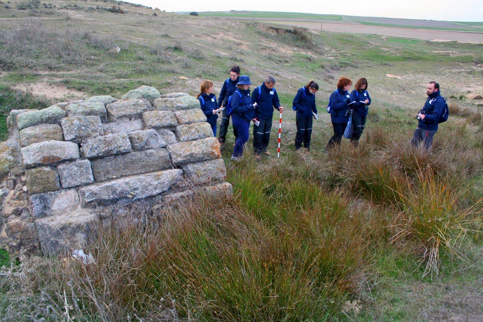
The greenway crosses between the two Arapil hills, through the centre of what was once the Battlefield (km 6). An interpretation panel provides more information about this historic site. We also recommend visiting Arapil Grande, which features views from the top of the hill and a monument commemorating the battle. From here we can tour these historic sites at the place where the greenway crosses the DSA-106 road and visit the village of Arapiles, where there is a Battle of Salamanca Interpretation Centre. This road, towards the left, leads to Calvarrasa de Arriba, 3 km from the greenway. Nevertheless, a little further on, we can also reach this locality via an agricultural road.
 The greenway continues through a transitional area towards pastureland featuring more and more holm oaks, where we frequently see cattle grazing, making the most of this humanised wooded pastureland in the Salamanca countryside. The following landmark, just a few metres from the greenway, will be the former installations of a ceramics factory called “El Carmen” (km 9), followed by, a little further on, the surroundings of the Maza de Alba hamlet and an old halt, which has been abandoned and is now occupied by cattle. The greenway continues through a transitional area towards pastureland featuring more and more holm oaks, where we frequently see cattle grazing, making the most of this humanised wooded pastureland in the Salamanca countryside. The following landmark, just a few metres from the greenway, will be the former installations of a ceramics factory called “El Carmen” (km 9), followed by, a little further on, the surroundings of the Maza de Alba hamlet and an old halt, which has been abandoned and is now occupied by cattle.
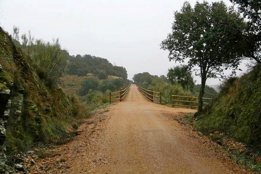
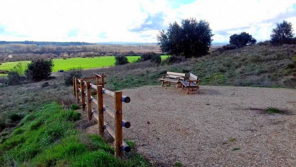
From here on, pastureland is present on both sides of the greenway. Advancing along the route, we enter a section of trenches. The shrubby vegetation frequently features young holm oaks, hawthorns, wild rose bushes and rockroses. This is spontaneous native vegetation and a good place for contemplating the area’s geology and Salamanca’s characteristic landscape featuring different stockbreeding uses and ways of exploiting the pastureland. A highly naturalised section brings us to the river called Arroyo del Valle. Here there is an interpretation panel explaining this landscape featuring wooded pastureland, along with several benches, which makes it a good stopping place.
 This river marks a transition. We now return to a greenway bordered by fields of crops. Further on we can see Terradillos (km 15), a village located 500 m to the left of the greenway. This municipality still features outstanding elements of traditional architecture and ethnographic value. We are in the highest part of the route. From now on we will descend to Alba de Tormes, going through an extensive riverside landscape on the left and wooded pastureland on the right. We will come across a viewpoint overlooking the banks of the Tormes River, with an excellent panoramic view of the riverside forest and the Historic Town of Alba de Tormes. This is a good place for birdwatching, featuring the presence of red kites or short-toed eagles. This river marks a transition. We now return to a greenway bordered by fields of crops. Further on we can see Terradillos (km 15), a village located 500 m to the left of the greenway. This municipality still features outstanding elements of traditional architecture and ethnographic value. We are in the highest part of the route. From now on we will descend to Alba de Tormes, going through an extensive riverside landscape on the left and wooded pastureland on the right. We will come across a viewpoint overlooking the banks of the Tormes River, with an excellent panoramic view of the riverside forest and the Historic Town of Alba de Tormes. This is a good place for birdwatching, featuring the presence of red kites or short-toed eagles.
We now carefully cross the DSA-120 road, which also leads to the route’s “terminus” locality. We can finish here, crossing the Tormes River via this road and entering the centre of the town. However, we can also continue on for a few metres. A signal from the old railway line marks the last trench and the final metres until we come to a rest area, car park and information panel in the station of Alba de Tormes (km 20.2).
The view from here features wooded pastureland towards the west and a riverside landscape towards the east, which is classified as the Riberas de Río Tormes y Afluentes SCI (Site of Community Importance). A good place for ending our trip, combining the natural attractions of the River Tormes and the cultural attractions of Alba de Tormes, linked to St. Teresa of Jesus.
Travellers will undoubtedly be interested to know that there is an urban route featuring information signs, making is possible to tour all of the town’s important sites.
The route ends here, but there are plans to restore new sections of this railway line in the province of Salamanca, in order to link it in the south with the Béjar - Casas del Monte section, located more than 60 km away; this will enable it to pass through the “tasty” region of Güijuelo.
|
|
|
|
|
|
|
| Railway History
|
|
Photo: Railway Historical Archive of the Railway
Museum of Madrid (SALGADO LANCHA, JUAN).
|
This railway line was officially opened on June 21, 1896, with the objective of connecting the western side of the Iberian Peninsula.
To that end, the original company was restructured and renamed “Compañía de Explotación de los Ferrocarriles de M.C.P. y del Oeste.” Under this name, work began on this great iron backbone connecting Astorga, on the Compañía del Norte’s line from Madrid to Coruña, with Palazuelo, a junction in the Plasencia countryside that formed part of the line from Madrid to Caceres and Portugal. This new line provided access to two provincial capitals, Salamanca and Zamora, and passed through localities such as the town of Bejár or the commercial centres of Plasencia, Benavente and La Bañeza.
The line was publicly owned from 1928 onwards. A new company was created (“Compañía Nacional del Oeste”) to merge the area’s Iberian-gauge railways. The railroad played a crucial role during the Spanish Civil War, being used as a logistical tool by the rebels. However, due to a certain degree of abandonment, as was the case with other transversal lines in Spain, it was inexplicably closed in 1985, firstly only for passenger services and finally, in 1996, for all traffic. Only the branch line to Plasencia survived.
|
|
|
|
| Interesting Data
|
|
|
|
|
|
|
|
|
|
|
|
1. Festivals and holidays |
|
|
.jpg)
|
|
|
|
|
2. Accommodation |
|
|
|
|
|
|
3. Eco-tourism |
|
|
|
|
|
|
4. Managing Authority |
|
|
|
|
|
|
5. Town Councils |
|
|
|
|
|
|
6. Emergencies |
|
|
|
|
|
|
7. Buses and Railway |
|
|
|
|
|
|
|
|
|
|
|
|
|
|
|
|
|
|
|
Festivals and holidays
|
 volver volver |
|
|
|
Carbajosa de la Sagrada
July 12th -14th
Festivities of the Lord
August 12th -18th
Festivities in honor of San Roque
Arapiles
January 19th - 21st
Festivities in honor of San Sebastián
End of July
Historical reenactment of the
Batter of Los Arapiles
December 8th -10th
Patronal festivities "Las Torres"
in honor of Santa Eulalia
Calvarrasa de Arriba
Beginning of June
Celebrations in honor of Virgen de la Peña
June 29th
Patronal festivities in honor of San Pedro
Terradillos
February 5th
Las Aguedas
|
|
End of February
Carnivals
August 15th
Our Lady of the Assumption
September 4th
Virgen de la Encina
Alba de Tormes
End of February
Carnival
During July
Festivity of San Antonio
During August
Festivities of the Transverberación
September 1st - 2nd
Festivities of the Virgen de Otero
During October
Patronal festivities in honor of Santa Teresa
|
|
|
|
Accommodation
|
 volver volver |
|
|
|
Calvarrasa de Arriba
Casa rural Las Moradas
Tel. 923 266 929
Terradillos
Casa rural La cosa de Teradillos
Tel. 923 306 329
Alba de Tormes
Hotel Alameda **
Tel. 923 300 031
|
|
Hostal América
Tel. 923 300 071
Hotel Don Fadrique **
Tel. 923 370 076
Hostal El Trebol
Tel. 923 300 089
|
|
|
|
|
 volver volver |
|
|
|
Bikecicletas Salamanca
Bycicle rental and guided routed by bycicle in the province of Salamanca
Tel. 699 210 939 / 630 509 026
|
|
|
|
|
|
|
Managing Authority
|
 volver volver |
|
|
|
Vía Férrea de la Plata Association (VIFEPLA)
Salamanca
Tel. 923 373 086
|
|
|
|
|
Town Councils
|
 volver volver |
|
|
|
Carbajosa de la Sagrada
Tel. 923 208 019
Arapiles
Calvarrasa de Arriba
Tel. 923 308 382
|
|
Terradillos
Tel. 923 373 086
Alba de Tormes
Tel. 923 300 024
|
|
|
|
|
|
|
|
|
Tel. 112 and 062
|
|
|
|
|
|
|
|
Buses and Railway
|
 volver volver |
|
|
|
Moga buses
Salamanca-Alba de Tormes line
Tel. 923 244 641
Salamanca station
Tel. 912 320 320
|
|
|
|
|
|
|
|
|
|
|
|
|
|
| Multimedia
|
|
Photo gallery
Photos: ©VIFEPLA
|
|
|
| Links
|
Junta de Castilla y León .jpg)
Tourism website of Castilla y León
Tourism website of Salamanca County Council
Tourism website of Salamanca
Natural Ways Programme of the Ministerio de
Agricultura, Pesca y Alimentación
Hiking and cycling trails in Spain
Historical Site of Arapiles
|
|
|
|
|
|
|
