|
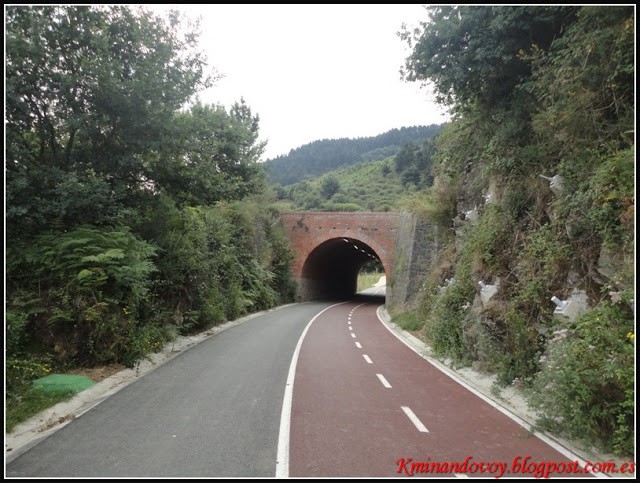
This Bizkaia Greenway, which actually looks like a bidegorri (cycle path), links Trapagaran and the surroundings of La Orkonera (Ortuella). It follows the route of the old mining railway belonging to the Franco-Belga company, which ran from Retuerto, in Barakaldo, to the mines of La Arboleda in Trapagaran.
 It forms part of Bilbao’s Green Belt, which is made up of green spaces integrated into urban surroundings that, surprisingly, include mountains, forests, reservoirs, rivers and streams, beaches, marshes and dunes, cliffs, etc. The main feature is the Estuary of Bilbao, and they are connected to the urban area by means of open spaces in the surrounding municipalities, mainly featuring parks and gardens. It forms part of Bilbao’s Green Belt, which is made up of green spaces integrated into urban surroundings that, surprisingly, include mountains, forests, reservoirs, rivers and streams, beaches, marshes and dunes, cliffs, etc. The main feature is the Estuary of Bilbao, and they are connected to the urban area by means of open spaces in the surrounding municipalities, mainly featuring parks and gardens.
The natural, seminatural and rural landscapes that now coexist in Bilbao are highly diverse and valuable, due to their singularity and the natural elements that exist therein. The Orkonera Greenway will enable you to discover one of these rich spaces.
This greenway runs along the mountainside, featuring pastureland, hamlets and Atlantic vegetation. In the past, Montes de Triano was an area of extensive mining activity, resulting in a lunar landscape. When mining came to an end, nature once again covered the slag heaps and remains of industrial archaeology with green, while the craters of the old mines have become peaceful lakes after filling with underground water. The Peñas Negras Interpretation Centre is a fine resource for discovering and exploring this anthropized, but naturalised, area.
Start
 If we decide to begin the route at the eastern end (Ortuella), it is worth noting that there is a carpark beside the toll area of the Variante Sur Metropolitana motorway. The carpark can be accessed by an asphalt turn-off at km 11 on the BI-3747 road, beside a pillar and under the impressive concrete structure supporting the AP-8 motorway, very close to the roundabout on the N-634 road, almost opposite the north entrance of the Ugarte-Ade industrial estate. If we decide to begin the route at the eastern end (Ortuella), it is worth noting that there is a carpark beside the toll area of the Variante Sur Metropolitana motorway. The carpark can be accessed by an asphalt turn-off at km 11 on the BI-3747 road, beside a pillar and under the impressive concrete structure supporting the AP-8 motorway, very close to the roundabout on the N-634 road, almost opposite the north entrance of the Ugarte-Ade industrial estate.
On the contrary, if we prefer to begin at the western end in the Trápaga/Trapagaran Valley, from the road between Ortuella and La Orkonera district, beside the Cadegal neighbourhood, there is an asphalt road that goes down a steep slope to the beginning of the greenway (about 300 m).
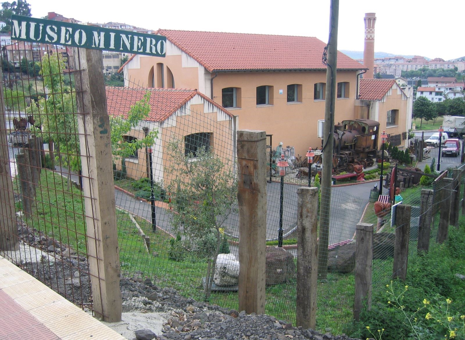
Here we describe the route beginning from the Trápaga/Trapagaran Valley to the Basque Country Mining Museum, which is an exceptional way of finishing this route.
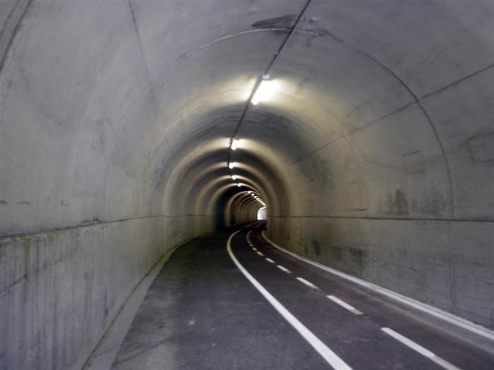
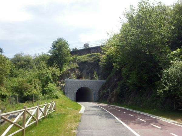
It is actually a comfortable, 2-lane bidegorri (cycle path) that is 3 metres wide, with a pedestrian area that is about 2.5 m wide. Throughout the route, we have to go through a total of 6 tunnels –all of which have lighting with motion sensors– that were used by the old mining train. Nonetheless, it is advisable to bring along lights in case there are any technical problems. It also features 3 well-equipped rest areas, where we can enjoy beautiful views of the villages on the left hand, which arose thanks to the iron mined from Montes de Trajano.
The greenway begins by going under the A-8 motorway. A large hairpin bend, which identifies these old railway lines, soon reveals that this must have been where the trains full of iron ore passed by. Nonetheless, the route cannot be missed. We just have to follow the asphalt cycle path until the end. The wooded scenery from the beginning makes us forget the nearby industrial estates of Greater Bilbao. After crossing the road of the Ugare Alde industrial estate, and a stream over a small bridge (km 1.5), we soon come to the route’s first tunnel.
 O n coming out of the tunnel, we can stop in Parque mirador (km 2.5), a viewpoint featuring a play area and picnic tables. Straightaway, the second tunnel appears, while the greenway continues to be bordered by pleasant woodland, providing shade throughout a large part of the itinerary.
After leaving the village of Halcón behind on the right, we will soon come across the
BI-3755 road, which, although it will first appear on our right, we will then go under without realising it, thanks to another tunnel (the 4th one). We are now at km 3. On coming out of the tunnel, first a clearer area, the 5th tunnel, and then a more wooded area brings us closer to the end of the route.
The longest tunnel of them all (the 6th) will be the route’s last railway feature. Here, 4 km from the start and in the surroundings of the old mineral dump of La Orconera, the greenway, strictly speaking, comes to an end.
 Nevertheless, when the bicolour cycle path ends, a small road with surface markings for pedestrians and bikes, but with little traffic (although you always have to be careful), brings us, after 2 km, to the Basque Country Mining Museum located in the district of Campodiego de Gallarta (Abanto-Zierbena). It is worth noting that the route beyond the railway line features a couple of points with steep slopes of up to 12%. These are two short, but sharp, gradients. Nevertheless, when the bicolour cycle path ends, a small road with surface markings for pedestrians and bikes, but with little traffic (although you always have to be careful), brings us, after 2 km, to the Basque Country Mining Museum located in the district of Campodiego de Gallarta (Abanto-Zierbena). It is worth noting that the route beyond the railway line features a couple of points with steep slopes of up to 12%. These are two short, but sharp, gradients.
Undoubtedly, the museum is highly recommendable and is the perfect way to end this excursion. However, from here we have the interesting opportunity of connecting with the Montes de Hierro Greenway. A 42.5-km itinerary that enables us to reach La Arena Beach in Muskiz, if we take the greenway to the right, or the Traslaviña halt if we take the left branch towards the south.
|
