Km 0
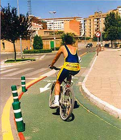 The
route begins at the present-day railway
station. After visiting the city, home to a
vast architectural heritage, we leave the
station by a newly built ramp that takes us
onto a green painted cycle path on a street
called Camino Caritat which will lead us to
the Greenway proper. Just before we leave
this medieval city we pass by an old steam
locomotive – now the centrepiece of a
fountain – which used to run on the
Tarazonica railway.
The street leads to a bridge over the active
Renfe railway lines. Once on the other side
we turn left onto the Greenway and start to
follow the old Tarazonica line. Here the old
railway parts company with the main Renfe
lines and makes quite a sharp curve to the
south towards Tarazona and the Moncayo
mountain.
After crossing the old main road we begin to
see fields of vegetables, a typical sight
along the lowlands of the Ebro and Queiles
and one which will dominate the landscape
for practically the entire journey. We also
embark on a series of long straight sections
which will make our journey just a little
bit faster.
Km 3,3
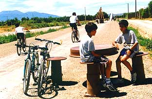 A
rural track appears on our right which forms
part of the route the Tarazonica used to
take when it was a narrow gauge railway,
before it was taken over by Renfe. From here
the railway took a straighter route into
Tudela station, past the citys bullring.
Shortly we arrive at a rest area scattered
with railway artefacts.
Km 4
After crossing the Ablitas road by a new,
purpose-built bridge, we arrive at an olive
grove. Once on the other side of the road
our Greenway crosses the Canal de Lodosa
which irrigates the local vegetable fields
with water from the Ebro. For those wishing
to make an extra excursion, the access
tracks to the canal provide alternative
routes. To the left of this canal lies the
Canal Imperial de Aragón and, if we still
want more, these access paths link up with
other disused railways: the Cinco Villas
Greenway (between Sádaba and Gallur) and the
Campo de Borja Greenway (between Agón and
Borja).
Km 6
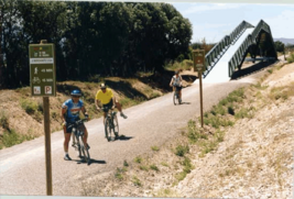 On
the other side of the canal, another
straight run leading us nearer the Moncayo
mountain passes underneath a motorway and a
rural track before arriving at Murchante
station. The station is nearly 2 km from the
village of Murchante and there is a plan to
convert the station building into a hostel
for travellers. However, it is already an
ideal place to take a break as the railway
yard has been converted into a rest area.
Once beyond Murchante the landscape is once
again dominated by fields of vegetables. The
rail bed of the previous narrow gauge
railway curves towards us on our left and
then runs almost parallel to our Greenway
until we enter the town of Cascante.
On
the other side of the canal, another
straight run leading us nearer the Moncayo
mountain passes underneath a motorway and a
rural track before arriving at Murchante
station. The station is nearly 2 km from the
village of Murchante and there is a plan to
convert the station building into a hostel
for travellers. However, it is already an
ideal place to take a break as the railway
yard has been converted into a rest area.
Once beyond Murchante the landscape is once
again dominated by fields of vegetables. The
rail bed of the previous narrow gauge
railway curves towards us on our left and
then runs almost parallel to our Greenway
until we enter the town of Cascante.
Km 7,6
A little further on we pass by the ruins of
the abandoned village of Urzante. Then we
start to climb gradually towards the first
major embankment on our route, where we pass
by dense reed beds growing in pools of
standing water alongside the railway track.
From this viewpoint we can catch a glimpse
of the village of Cascante on our right and
the spectacular cloister leading up to the
Basilica del Romero.
Km 10
We soon arrive at Cascante station, where
another rest area awaits us. Here we can see
the peculiar station building that used to
serve the narrow gauge railway, built on a
higher level than the modern one.
Km 12
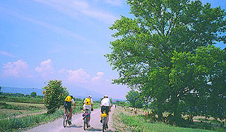 Our
arrival at Tulebras is signalled by the
outer wall of the Monastery of Santa María
de la Caridad, founded in the 12th century
as the first Cistercian convent for nuns in
Spain. This monastery is intimately linked
with our Greenway, since the old station
building of Tulebras forms part of the
monastic precinct, and passengers are free
to walk round its courtyards and cloisters.
After visiting the convent, we can enjoy the
rest area on the banks of the river Queiles,
in Tulebras – the last village in Navarra.
The rest area is just a short distance from
the station on the Barillas road.
Another good place to stop is a bridge just
over 500 metres out of Tulebras, which is
high enough to provide a good view of the
Greenway and its surrounding area. From here
we can see the orchards, the greyish heights
of the Moncayo mountain – snow capped from
November to March - and, at the end of a
long straight section, the village of Malón.
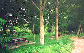
Km 15
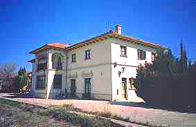
We arrive at the two stations of Malón; one
used to be for the narrow gauge railway and
the other for the broad gauge railway. A
family of railway workers still live in the
latter, where old railway artefacts leave us
in no doubt about its origins. A rest area
has been prepared on one of the platforms
for those wishing to take a break.
 Above
us and to our left the village of Malón sits
on a hill. At the top of the hill there is
an esplanade, the parade ground of a long
gone castle. The battlements have
disappeared, but there is still a good view
over the Queiles lowlands.
We continue on our way and once again the
rail bed of the old narrow gauge railway
appears, this time on our right. Further on
there are a number of large groves of trees,
the first of which has been prepared as a
rest area.
Km 16
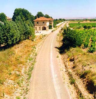 Now
we enter a cutting nearly two kilometres
long. For those not wishing to take that
route there is an alternative one using the
route of the old narrow gauge line. This
route, to the right and above the main one,
takes a longer and curvier way round but
affords us better views of the valley. Both
lines meet again at the site of the Apeadero
de Vierlas, a railway halt that was built
but never used.
Orchards of fruit trees, which in spring are
heavy with blossom, line this part of the
route. A rest area has been prepared in a
densely wooded spot of this bucolic area.
Km 22
Now we are approaching Tarazona and its
station, the large main building of which is
now a cultural centre. It is an eye-catching
entrance to a city with a valuable
architectural heritage, and a fitting end to
our Tarazonica Greenway.
