| Technical Data
|
|
 CONDITIONED GREENWAY CONDITIONED GREENWAY
|
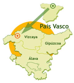
On the plain of Atxuri river
LOCATION
Among Mungia and the foothills of Mount Artebakarra
VIZCAYA
Length: 3,8 Km
Type of surface:
Asphalt
Natural landscape:
|
|
 |
|
Mungia: Valleys of the Atxuri stream and Butrón river. Uriguen Park in Mungia
Cultural heritage:
Mungia: Town hall, Palacio Aguirre, church of San Pedro (of Roman origin, with an Isabelline Gothic facade), Casa Torre Billela (11th century building), town gate (Katetxe), Caserío Landetxo-Goikoa (country house), the chapel of San Miguel de Zumetzaga (Romanesque gem of the 21st century), and the Concordia fountain
Infraestructure:
Greenway. 1 bridge and 1 rural overpass. You can still see some old line electrification posts. Along the route there are drinking fountains, benches, waste bins, kilometre stones, signposts and information panels. The first kilometre has lighting
How to get there:
Mungia. Autobuses Bizkaibus. Lines A3516 (Bilbao-Mungia by motorway), A3517 (Bilbao-Derio-Mungia) y A3518 (Bilbao-Derio-Mungia-Bakio)
Connections:
Bilbao: 16.5 km from Mungia.
Further information in the Greenways Guide, volume III
|
|
|
|
| Description
|
|
Km. 0 / Km. 1,1 / Km. 2 / Km. 3
|
Km 0
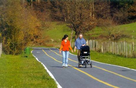 The
Atxuri Greenway, developed by the Diputación
Foral de Bizkaia (Vizcaya Provincial Council),
starts in the historic town of Mungia. More
precisely it starts in the lower part of
Uriguen Park, next to the recreational area,
the children’s playground, and the car park
on the west side of the park. This green
area, perched on a hill, is shaded by some
very old trees, both exotic and indigenous,
forming a veritable arboretum in which the
species of some of the trees are identified
by plaques. For the enjoyment of the park’s
visitors a number of paths have been laid
out, inviting us to climb to the top of the
park and visit the Caserío de Landetxo
Goikoa (a 16th century country house),
considered to be the oldest in Vizcaya. Once
a year the peace of the Uriguen gardens is
shattered by the local festivities; a
competition to find the best sukalki (a meat
and potato stew) is held in the confines of
the park. If you are lucky enough to arrive
in Mungia that day, congratulations. The
Atxuri Greenway, developed by the Diputación
Foral de Bizkaia (Vizcaya Provincial Council),
starts in the historic town of Mungia. More
precisely it starts in the lower part of
Uriguen Park, next to the recreational area,
the children’s playground, and the car park
on the west side of the park. This green
area, perched on a hill, is shaded by some
very old trees, both exotic and indigenous,
forming a veritable arboretum in which the
species of some of the trees are identified
by plaques. For the enjoyment of the park’s
visitors a number of paths have been laid
out, inviting us to climb to the top of the
park and visit the Caserío de Landetxo
Goikoa (a 16th century country house),
considered to be the oldest in Vizcaya. Once
a year the peace of the Uriguen gardens is
shattered by the local festivities; a
competition to find the best sukalki (a meat
and potato stew) is held in the confines of
the park. If you are lucky enough to arrive
in Mungia that day, congratulations.
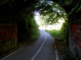 Following
the instructions of the ibilbidea (itinerary),
from Telmo Zarra Etxetaldea street, and with
your back to the children’s playground, the
Greenway sets out between the most recent
urban developments of Mungia and green
meadowlands. After crossing the Atxuri
stream and passing under the Derio-Mungia
motorway (BI-631), the route embarks on a
long straight running between the embankment
of the motorway and the river with its wake
of ash trees, oaks, poplars, hazel bushes,
maples, alders and willows. These trees lend
colour to the Autumn and strew their leaves
on the three lanes painted on the tarmac.
The Atxuri stream is one of the many small
watercourses which furrow these lands before
feeding into the Butrón, a proper river
which provides the backbone to the rural
district of Mungia. Following
the instructions of the ibilbidea (itinerary),
from Telmo Zarra Etxetaldea street, and with
your back to the children’s playground, the
Greenway sets out between the most recent
urban developments of Mungia and green
meadowlands. After crossing the Atxuri
stream and passing under the Derio-Mungia
motorway (BI-631), the route embarks on a
long straight running between the embankment
of the motorway and the river with its wake
of ash trees, oaks, poplars, hazel bushes,
maples, alders and willows. These trees lend
colour to the Autumn and strew their leaves
on the three lanes painted on the tarmac.
The Atxuri stream is one of the many small
watercourses which furrow these lands before
feeding into the Butrón, a proper river
which provides the backbone to the rural
district of Mungia.
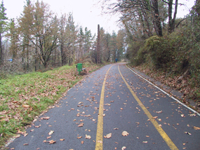 Although
their flow is scant, these small streams
bring water to the rich fruit and vegetable
croplands and pastures. They also used to
have more than enough force to power the
wheels of the mills and the hammers of the
ironworks. The wealth of the land was
evidenced by the loads of farm produce –
milk, calves, vegetables– and other goods
which used to fill the trains heading to
market in the capital city. Although
their flow is scant, these small streams
bring water to the rich fruit and vegetable
croplands and pastures. They also used to
have more than enough force to power the
wheels of the mills and the hammers of the
ironworks. The wealth of the land was
evidenced by the loads of farm produce –
milk, calves, vegetables– and other goods
which used to fill the trains heading to
market in the capital city.
At kilometre 0.6 we pass by the town’s
Atxuri district, which in the past was
solely devoted to livestock and agriculture.
A bridge over the river and its prolongation
in the form of a short concreted path
diverts us briefly towards this district.
Once again on the old rail bed, a little
before kilometre 1 we pass by the dirt road
which leads to the Atxuri mill (Atxuriko
errota). Mungia used to have over twenty
mills, and was the biggest flour producer of
the area. Of those twenty or so mills only
four remain in production, the Atxuri mill
unfortunately not being one of them.
Km 1,1
 The
Greenway passes under the motorway and
hugging the river the railway describes a
short sweeping curve before embarking on
another long straight. This second straight
is just as flat as the first, but even more
pleasant as it takes us away from the drone
of the vehicles driving along the motorway
and into the meadowland occupying the right
hand bank of the river in the modest Atxuri
valley. The water meadow is flanked by a
line of gentle grassy hills dotted with
pine, oak and eucalyptus groves. This
section is so pleasant and flat that it is a
great favourite with the local people of
Mungia who, come rain or shine, flock to it
to take a stroll nearly every day. The
Greenway passes under the motorway and
hugging the river the railway describes a
short sweeping curve before embarking on
another long straight. This second straight
is just as flat as the first, but even more
pleasant as it takes us away from the drone
of the vehicles driving along the motorway
and into the meadowland occupying the right
hand bank of the river in the modest Atxuri
valley. The water meadow is flanked by a
line of gentle grassy hills dotted with
pine, oak and eucalyptus groves. This
section is so pleasant and flat that it is a
great favourite with the local people of
Mungia who, come rain or shine, flock to it
to take a stroll nearly every day.
Km 2
 The
trail bends left and arrives at the old
Apeadero* de Zabalondo (km 2), whose gate
house is still home to the descendents of
the man who used to be responsible for
raising and lowering the gates of the level
crossing on the rural road to Laukariz.
After carefully crossing to the other side
of the road, we start to climb a tarmacked
section of Greenway, the steepest incline on
the route, which leads us away from the
river Atxuri. The locomotives, coal fired
until 1952, used to have to give it all they
had to cover the 12 kilometre incline in 50
minutes. The
trail bends left and arrives at the old
Apeadero* de Zabalondo (km 2), whose gate
house is still home to the descendents of
the man who used to be responsible for
raising and lowering the gates of the level
crossing on the rural road to Laukariz.
After carefully crossing to the other side
of the road, we start to climb a tarmacked
section of Greenway, the steepest incline on
the route, which leads us away from the
river Atxuri. The locomotives, coal fired
until 1952, used to have to give it all they
had to cover the 12 kilometre incline in 50
minutes.
The steep climb gives way to a tight turn
around the Zabalondo industrial estate. The
industrial workshops obscure our view of the
valley so all our attention is turned
towards the meadowlands and low rolling
hills to our left. On our way round
Zabalondo we cross the road which climbs up
to the Olena reservoir (km 2.7), whose
tranquil waters are bordered by a pretty
country lane.
Km 3
The final section is different; it’s the
cherry on the cake. The trail nestles into a
mountainous tree covered hillside and takes
on the appearance of a lofty balcony
overlooking the broad valley of the river
Butrón. From this privileged position we are
afforded panoramic views of green
pastureland, country houses and gentle
rolling hills. The route finishes at an area
of open ground overlooking the motorway, at
the foot of Mount Artebakarra.
|
|
|
|
|
|
|
|
| Railway History
|
|
La capital vizcaína, arrebolada en torno a la ría del Nervión, fue un hervidero de actividad industrial y logística desde mediados del siglo XIX. La minería del hierro, la siderurgia y el puerto articularon uno de los vectores de la revolución industrial española. Los ferrocarriles, correlato de la actividad económica, se desplegaron con generosidad a un lado y otro de la ría. Uno de ellos fue el que unía la estación de Lutxana, en pleno corazón de Bilbao, con la localidad de Mungia, en la comarca de Uribe. A diferencia de otros ferrocarriles, en esta comarca no había ni una mina o potente factoría que justificara esta línea. Fue pues, desde su origen, un ferrocarril de marcado carácter rural que fue gestionado primero por la empresa Ferrocarril de Luchana a Mungia y, tras la guerra civil, se incorporó a la red de la empresa Ferrocarriles y Transportes Suburbanos de Bilbao. Era una línea de tráficos aceptables, ya que tuvo una clara especialización en el movimiento de pequeñas mercancías y, sobre todo, viajeros. Pero otro modo de transporte, el avión, tuvo mucho que ver con su muerte. La ampliación de las pistas del aeropuerto de Sondika, en 1975, se llevó por delante un trozo de aquel ferrocarril. Hoy día se hubieran estudiado alternativas, pero en aquella década resultaba muy sencillo clausurar una pequeña línea rural. Así, de esta manera, desde aquel año los trenes de esta línea concluyeron su recorrido en Sondika, quedando olvidado el resto del trazado entre prados y bosques hasta esta reciente redención en clave de vía verde.
|
|
|
|
|
| Links
|
|
Official Website of Tourism of the Basque Government.
Official Website of the Centers BTT Euskadi.
Official site for hiking in Euskadi
Website of the Regional Council of Bizkaia
Home Tourism Bizkaia Provincial Council.
Official website for tourism in the comarca of Uribe
Description sheet of the greenway Atxuri
Rural Tourism Accommodation
|
|
|
|
